Area Overview for S5 0EA
Photos of S5 0EA
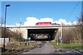
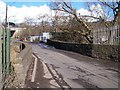
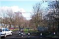
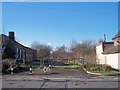
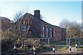
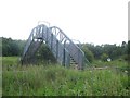

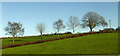
48 photos from this area
Area Information
Key information about the S5 0EA including its size, population, and administrative classification.
- Area Type
- Postcode
- Area Size
- 1.2 hectares
- Population
- 1591
- Population Density
- 4023 people/km²
House Prices in S5 0EA
47
Properties
£62,100
Average Sold Price
£3,500
Lowest Price
£130,000
Highest Price
Showing 47 properties
| Address | Type | Beds | Baths | Last Sale Price | Last Sale Date | |
|---|---|---|---|---|---|---|
| 1 Paper Mill Road, Sheffield, S5 0EA | Semi-detached | 3 | 1 | £130,000 | Mar 2025 | |
| Former 9, Paper Mill Road, Sheffield, S5 0EA | Semi-detached | 2 | 1 | £110,000 | May 2022 | |
| 71 Paper Mill Road, Sheffield, S5 0EA | Semi-detached | 2 | - | £116,500 | Oct 2021 | |
| 19 Paper Mill Road, Sheffield, S5 0EA | house | 2 | - | £83,500 | Sep 2019 | |
| 31 Paper Mill Road, Sheffield, S5 0EA | Bungalow | - | - | £3,500 | Oct 2017 | |
| 35 Paper Mill Road, Sheffield, S5 0EA | Bungalow | - | - | £75,000 | Oct 2016 | |
| 57 Paper Mill Road, Sheffield, S5 0EA | house | 2 | 1 | £50,000 | Mar 2012 | |
| 21 Paper Mill Road, Sheffield, S5 0EA | Terraced | 2 | 1 | £18,000 | Mar 2003 | |
| 33 Paper Mill Road, Sheffield, S5 0EA | Bungalow | - | - | £19,500 | Dec 2001 | |
| 43 Paper Mill Road, Sheffield, S5 0EA | Semi-detached | 3 | 1 | £15,000 | Oct 2001 |
Page 1 of 5
Energy Efficiency in S5 0EA
Amenities
Schools
| Rank | School | Type | Entry gender | Ages |
|---|
Explore more schools in this area
Go to Schools tabDemographics
Household Size
Family (3-5 people)
most common
Accommodation Type
Houses
most common
Tenure
34
majority
Ethnic Group
White
most common
Religion
N/A
most common
Household Composition
N/A
most common
Age
47
median
Adults (30-64 years)
most common
Household Deprivation
N/A
with no deprivation
NS-SEC
14
in Lower managerial occupations
Explore more demographic insights in this area
Go to Demographics tabPlanning
Planning Constraints
- Flood RiskPremium
- Ramsar Wetland SitesPremium
- Area of Outstanding Natural BeautyPremium
- Protected Nature ReservePremium
- Protected WoodlandPremium