Area Overview for S5 0DS
Photos of S5 0DS
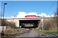
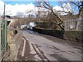
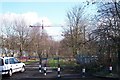
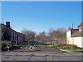
48 photos from this area
Area Information
Key information about the S5 0DS including its size, population, and administrative classification.
- Area Type
- Postcode
- Area Size
- 2.9 hectares
- Population
- 1312
- Population Density
- 1819 people/km²
House Prices in S5 0DS
46
Properties
£81,622
Average Sold Price
£33,000
Lowest Price
£140,000
Highest Price
Showing 46 properties
| Address | Type | Beds | Baths | Last Sale Price | Last Sale Date | |
|---|---|---|---|---|---|---|
| 6 Deep Lane, Sheffield, S5 0DS | Semi-detached | 3 | 1 | £140,000 | Jan 2025 | |
| 12 Deep Lane, Sheffield, S5 0DS | Terraced | 3 | 1 | £135,000 | Dec 2022 | |
| 10 Deep Lane, Sheffield, S5 0DS | house | - | - | £120,000 | Jan 2021 | |
| 19 Deep Lane, Sheffield, S5 0DS | Semi-detached | 3 | - | £90,000 | Nov 2019 | |
| 53 Deep Lane, Sheffield, S5 0DS | house | - | - | £83,000 | Feb 2018 | |
| 39 Deep Lane, Sheffield, S5 0DS | Terraced | 3 | 1 | £59,000 | Oct 2015 | |
| 13 Deep Lane, Sheffield, S5 0DS | Terraced | 3 | 1 | £72,500 | Dec 2007 | |
| 31 Deep Lane, Sheffield, S5 0DS | Semi-detached | 3 | 1 | £90,000 | Aug 2007 | |
| 20 Deep Lane, Sheffield, S5 0DS | house | - | - | £74,000 | Oct 2006 | |
| 33 Deep Lane, Sheffield, S5 0DS | Semi-detached | - | - | £89,950 | Jul 2006 |
Page 1 of 5
Energy Efficiency in S5 0DS
Amenities
Schools
| Rank | School | Type | Entry gender | Ages |
|---|
Explore more schools in this area
Go to Schools tabDemographics
Household Size
Family (3-5 people)
most common
Accommodation Type
Houses
most common
Tenure
47
majority
Ethnic Group
White
most common
Religion
N/A
most common
Household Composition
N/A
most common
Age
47
median
Adults (30-64 years)
most common
Household Deprivation
N/A
with no deprivation
NS-SEC
17
in Lower managerial occupations
Explore more demographic insights in this area
Go to Demographics tabPlanning
Planning Constraints
- Flood RiskPremium
- Ramsar Wetland SitesPremium
- Area of Outstanding Natural BeautyPremium
- Protected Nature ReservePremium
- Protected WoodlandPremium