Area Overview for S36 9RL
Photos of S36 9RL

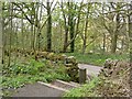
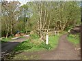
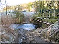
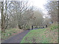
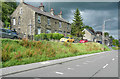


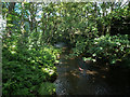
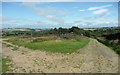
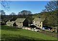

41 photos from this area
Area Information
Key information about the S36 9RL including its size, population, and administrative classification.
- Area Type
- Postcode
- Area Size
- 18.9 hectares
- Population
- 1675
- Population Density
- 1983 people/km²
House Prices in S36 9RL
47
Properties
£141,824
Average Sold Price
£44,500
Lowest Price
£220,000
Highest Price
Showing 47 properties
| Address | Type | Beds | Baths | Last Sale Price | Last Sale Date | |
|---|---|---|---|---|---|---|
| 3 Westfield Avenue, Thurlstone, Barnsley, S36 9RL | Semi-detached | 2 | 1 | £208,500 | Jun 2025 | |
| 39 Westfield Avenue, Thurlstone, Barnsley, S36 9RL | house | - | - | £186,000 | Oct 2024 | |
| 57 Westfield Avenue, Thurlstone, Barnsley, S36 9RL | Semi-detached | 3 | 1 | £177,000 | Jan 2024 | |
| 45 Westfield Avenue, Thurlstone, Barnsley, S36 9RL | Semi-detached | 3 | 1 | £220,000 | Oct 2023 | |
| 51 Westfield Avenue, Thurlstone, Barnsley, S36 9RL | Semi-detached | 3 | 1 | £210,000 | Jun 2023 | |
| 17 Westfield Avenue, Thurlstone, Barnsley, S36 9RL | Semi-detached | 2 | - | £187,000 | Jan 2023 | |
| 43 Westfield Avenue, Thurlstone, Barnsley, S36 9RL | Semi-detached | 3 | - | £185,000 | Jul 2022 | |
| 85 Westfield Avenue, Thurlstone, Barnsley, S36 9RL | Flat | 1 | 1 | £92,000 | Sep 2019 | |
| 31 Westfield Avenue, Thurlstone, Barnsley, S36 9RL | house | 4 | 1 | £158,000 | Mar 2015 | |
| 75 Westfield Avenue, Thurlstone, Barnsley, S36 9RL | Flat | - | - | £87,000 | Mar 2014 |
Page 1 of 5
Energy Efficiency in S36 9RL
Amenities
Schools
| Rank | School | Type | Entry gender | Ages |
|---|
Explore more schools in this area
Go to Schools tabDemographics
Household Size
Two person
most common
Accommodation Type
Houses
most common
Tenure
75
majority
Ethnic Group
White
most common
Religion
N/A
most common
Household Composition
N/A
most common
Age
47
median
Adults (30-64 years)
most common
Household Deprivation
N/A
with no deprivation
NS-SEC
40
in Lower managerial occupations
Explore more demographic insights in this area
Go to Demographics tabPlanning
Planning Constraints
- Flood RiskPremium
- Ramsar Wetland SitesPremium
- Area of Outstanding Natural BeautyPremium
- Protected Nature ReservePremium
- Protected WoodlandPremium