Area Overview for S36 7JJ
Photos of S36 7JJ
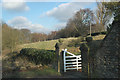

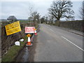
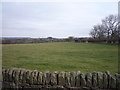
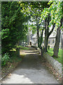
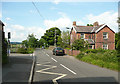
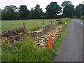
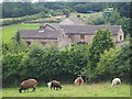
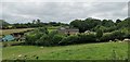
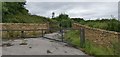

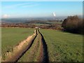
27 photos from this area
Area Information
Key information about the S36 7JJ including its size, population, and administrative classification.
- Area Type
- Postcode
- Area Size
- 7.8 hectares
- Population
- 1842
- Population Density
- 170 people/km²
House Prices in S36 7JJ
39
Properties
£398,422
Average Sold Price
£95,000
Lowest Price
£1,500,000
Highest Price
Showing 39 properties
| Address | Type | Beds | Baths | Last Sale Price | Last Sale Date | |
|---|---|---|---|---|---|---|
| 35 Haigh Lane, Hoylandswaine, Barnsley, S36 7JJ | house | 4 | 2 | £552,500 | Apr 2025 | |
| 29 Haigh Lane, Hoylandswaine, Barnsley, S36 7JJ | house | - | - | £760,000 | Dec 2022 | |
| Jubilee Reading Rooms, Haigh Lane, Hoylandswaine, Barnsley, S36 7JJ | house | 3 | - | £311,000 | Jul 2021 | |
| The Old Vicarage, 89 Haigh Lane, Hoylandswaine, Barnsley, S36 7JJ | house | - | - | £1,500,000 | Mar 2021 | |
| 21 Haigh Lane, Hoylandswaine, Barnsley, S36 7JJ | house | - | - | £197,500 | Dec 2018 | |
| 11 Haigh Lane, Hoylandswaine, Barnsley, S36 7JJ | house | - | - | £220,000 | Oct 2018 | |
| 3 Haigh Lane, Hoylandswaine, Barnsley, S36 7JJ | Semi-detached | 2 | 1 | £185,000 | Sep 2017 | |
| 45 Haigh Lane, Hoylandswaine, Barnsley, S36 7JJ | house | 5 | - | £465,000 | Dec 2016 | |
| 19 Haigh Lane, Hoylandswaine, Barnsley, S36 7JJ | Terraced | 3 | 1 | £155,000 | Jul 2014 | |
| Willow House, 33 Haigh Lane, Hoylandswaine, Barnsley, S36 7JJ | Detached | 4 | - | £292,500 | Jun 2011 |
Page 1 of 4
Energy Efficiency in S36 7JJ
Amenities
Schools
| Rank | School | Type | Entry gender | Ages |
|---|
Explore more schools in this area
Go to Schools tabDemographics
Household Size
Two person
most common
Accommodation Type
Houses
most common
Tenure
89
majority
Ethnic Group
White
most common
Religion
N/A
most common
Household Composition
N/A
most common
Age
47
median
Adults (30-64 years)
most common
Household Deprivation
N/A
with no deprivation
NS-SEC
49
in Lower managerial occupations
Explore more demographic insights in this area
Go to Demographics tabPlanning
Planning Constraints
- Flood RiskPremium
- Ramsar Wetland SitesPremium
- Area of Outstanding Natural BeautyPremium
- Protected Nature ReservePremium
- Protected WoodlandPremium