Area Overview for S36 6AP
Photos of S36 6AP
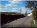
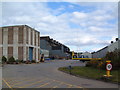
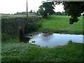
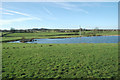
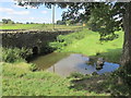
37 photos from this area
Area Information
Key information about the S36 6AP including its size, population, and administrative classification.
- Area Type
- Postcode
- Area Size
- 3825 m²
- Population
- 1692
- Population Density
- 2832 people/km²
House Prices in S36 6AP
23
Properties
£98,788
Average Sold Price
£27,000
Lowest Price
£192,500
Highest Price
Showing 23 properties
| Address | Type | Beds | Baths | Last Sale Price | Last Sale Date | |
|---|---|---|---|---|---|---|
| 2 Castle Street, Penistone, Barnsley, S36 6AP | Terraced | 3 | 1 | £192,500 | Oct 2024 | |
| 5 Castle Street, Penistone, Barnsley, S36 6AP | Terraced | 3 | - | £105,500 | Jan 2024 | |
| 17 Castle Street, Penistone, Barnsley, S36 6AP | Terraced | 3 | 1 | £167,000 | Jun 2022 | |
| 9 Castle Street, Penistone, Barnsley, S36 6AP | Terraced | 2 | 1 | £146,775 | Jan 2022 | |
| 13 Castle Street, Penistone, Barnsley, S36 6AP | Terraced | 2 | 1 | £147,000 | Aug 2021 | |
| 4 Castle Street, Penistone, Barnsley, S36 6AP | house | - | - | £125,000 | Jul 2020 | |
| 11 Castle Street, Penistone, Barnsley, S36 6AP | Terraced | 3 | 1 | £92,000 | Feb 2017 | |
| 8 Castle Street, Penistone, Barnsley, S36 6AP | Terraced | - | - | £114,000 | Jan 2008 | |
| 10 Castle Street, Penistone, Barnsley, S36 6AP | house | - | - | £117,000 | Dec 2006 | |
| 21 Castle Street, Penistone, Barnsley, S36 6AP | Terraced | 3 | 1 | £85,500 | Apr 2005 |
Page 1 of 3
Energy Efficiency in S36 6AP
Amenities
Schools
| Rank | School | Type | Entry gender | Ages |
|---|
Explore more schools in this area
Go to Schools tabDemographics
Household Size
Two person
most common
Accommodation Type
Houses
most common
Tenure
76
majority
Ethnic Group
White
most common
Religion
N/A
most common
Household Composition
N/A
most common
Age
47
median
Adults (30-64 years)
most common
Household Deprivation
N/A
with no deprivation
NS-SEC
39
in Lower managerial occupations
Explore more demographic insights in this area
Go to Demographics tabPlanning
Planning Constraints
- Flood RiskPremium
- Ramsar Wetland SitesPremium
- Area of Outstanding Natural BeautyPremium
- Protected Nature ReservePremium
- Protected WoodlandPremium