Area Overview for S36 1LF
Photos of S36 1LF
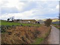
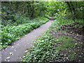
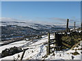
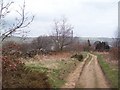
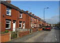
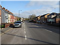
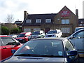
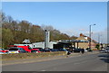
31 photos from this area
Area Information
Key information about the S36 1LF including its size, population, and administrative classification.
- Area Type
- Postcode
- Area Size
- 8283 m²
- Population
- 1415
- Population Density
- 956 people/km²
House Prices in S36 1LF
22
Properties
£127,450
Average Sold Price
£15,000
Lowest Price
£250,000
Highest Price
Showing 22 properties
| Address | Type | Beds | Baths | Last Sale Price | Last Sale Date | |
|---|---|---|---|---|---|---|
| 25 New Hall Crescent, Sheffield, S36 1LF | house | - | - | £195,000 | May 2024 | |
| 12 New Hall Crescent, Sheffield, S36 1LF | house | - | - | £250,000 | Jun 2019 | |
| 1 New Hall Crescent, Sheffield, S36 1LF | Detached | 3 | - | £158,000 | Aug 2014 | |
| 31 New Hall Crescent, Sheffield, S36 1LF | Detached | 3 | - | £170,000 | Mar 2014 | |
| 21 New Hall Crescent, Sheffield, S36 1LF | Semi-detached | - | - | £70,000 | Jan 2009 | |
| 4 New Hall Crescent, Sheffield, S36 1LF | Semi-detached | - | - | £150,000 | Dec 2006 | |
| 15 New Hall Crescent, Sheffield, S36 1LF | Semi-detached | - | - | £154,000 | Nov 2006 | |
| 13 New Hall Crescent, Sheffield, S36 1LF | Semi-detached | - | - | £130,000 | Aug 2005 | |
| 5 New Hall Crescent, Sheffield, S36 1LF | Semi-detached | - | - | £59,950 | Aug 2001 | |
| 6 New Hall Crescent, Sheffield, S36 1LF | Semi-detached | - | - | £50,000 | Feb 2000 |
Page 1 of 3
Energy Efficiency in S36 1LF
Amenities
Schools
| Rank | School | Type | Entry gender | Ages |
|---|
Explore more schools in this area
Go to Schools tabDemographics
Household Size
Two person
most common
Accommodation Type
Houses
most common
Tenure
89
majority
Ethnic Group
White
most common
Religion
N/A
most common
Household Composition
N/A
most common
Age
47
median
Adults (30-64 years)
most common
Household Deprivation
N/A
with no deprivation
NS-SEC
29
in Lower managerial occupations
Explore more demographic insights in this area
Go to Demographics tabPlanning
Planning Constraints
- Flood RiskPremium
- Ramsar Wetland SitesPremium
- Area of Outstanding Natural BeautyPremium
- Protected Nature ReservePremium
- Protected WoodlandPremium