Area Overview for S35 9WQ
Photos of S35 9WQ
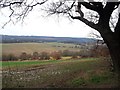
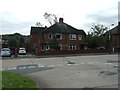
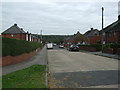
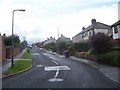
8 photos from this area
Area Information
Key information about the S35 9WQ including its size, population, and administrative classification.
- Area Type
- Postcode
- Area Size
- 10.3 hectares
- Population
- 1475
- Population Density
- 976 people/km²
House Prices in S35 9WQ
31
Properties
£230,095
Average Sold Price
£73,500
Lowest Price
£407,000
Highest Price
Showing 31 properties
| Address | Type | Beds | Baths | Last Sale Price | Last Sale Date | |
|---|---|---|---|---|---|---|
| 32 Crakehall Road, Sheffield, S35 9WQ | Detached | 4 | 2 | £320,000 | Jul 2023 | |
| 34 Crakehall Road, Sheffield, S35 9WQ | house | - | - | £360,000 | Feb 2022 | |
| 23 Crakehall Road, Sheffield, S35 9WQ | house | - | - | £407,000 | Mar 2021 | |
| 40 Crakehall Road, Sheffield, S35 9WQ | Detached | 4 | - | £337,500 | Aug 2015 | |
| 8 Crakehall Road, Sheffield, S35 9WQ | house | - | - | £192,000 | May 2014 | |
| 17 Crakehall Road, Sheffield, S35 9WQ | Detached | - | - | £230,000 | Aug 2009 | |
| 19 Crakehall Road, Sheffield, S35 9WQ | Detached | - | - | £199,950 | Jan 2006 | |
| 9 Crakehall Road, Sheffield, S35 9WQ | Bungalow | - | - | £96,000 | Feb 2002 | |
| 22 Crakehall Road, Sheffield, S35 9WQ | Semi-detached | - | - | £73,500 | Aug 1999 | |
| 11 Crakehall Road, Sheffield, S35 9WQ | Detached | - | - | £85,000 | May 1995 |
Page 1 of 4
Energy Efficiency in S35 9WQ
Amenities
Schools
| Rank | School | Type | Entry gender | Ages |
|---|
Explore more schools in this area
Go to Schools tabDemographics
Household Size
Two person
most common
Accommodation Type
Houses
most common
Tenure
92
majority
Ethnic Group
White
most common
Religion
N/A
most common
Household Composition
N/A
most common
Age
47
median
Adults (30-64 years)
most common
Household Deprivation
N/A
with no deprivation
NS-SEC
38
in Lower managerial occupations
Explore more demographic insights in this area
Go to Demographics tabPlanning
Planning Constraints
- Flood RiskPremium
- Ramsar Wetland SitesPremium
- Area of Outstanding Natural BeautyPremium
- Protected Nature ReservePremium
- Protected WoodlandPremium