Area Overview for S35 8RD
Photos of S35 8RD
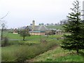
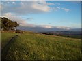
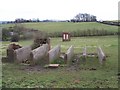
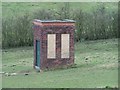
58 photos from this area
Area Information
Key information about the S35 8RD including its size, population, and administrative classification.
- Area Type
- Postcode
- Area Size
- 2.2 hectares
- Population
- 1531
- Population Density
- 742 people/km²
House Prices in S35 8RD
34
Properties
£160,843
Average Sold Price
£38,000
Lowest Price
£375,000
Highest Price
Showing 34 properties
| Address | Type | Beds | Baths | Last Sale Price | Last Sale Date | |
|---|---|---|---|---|---|---|
| 11 Top Side, Sheffield, S35 8RD | Terraced | 3 | 1 | £241,500 | Jul 2024 | |
| 45 Top Side, Sheffield, S35 8RD | house | - | - | £320,000 | Jun 2021 | |
| 15-17 Top Side, Sheffield, S35 8RD | house | - | - | £247,500 | Oct 2018 | |
| Southwold, Top Side, Sheffield, S35 8RD | house | 3 | - | £375,000 | May 2017 | |
| 31 Top Side, Sheffield, S35 8RD | Detached | 3 | 1 | £235,000 | May 2015 | |
| Wheel Cottage, 1 Top Side, Sheffield, S35 8RD | Terraced | - | - | £200,950 | Jun 2006 | |
| 7 Top Side, Sheffield, S35 8RD | Terraced | - | - | £135,000 | Sep 2005 | |
| Wheata Cottage, 33 Top Side, Sheffield, S35 8RD | house | - | - | £157,500 | Jul 2005 | |
| 23 Top Side, Sheffield, S35 8RD | house | - | - | £116,000 | Dec 2004 | |
| 21 Top Side, Sheffield, S35 8RD | Terraced | 2 | 1 | £115,000 | Aug 2004 |
Page 1 of 4
Energy Efficiency in S35 8RD
Amenities
Schools
| Rank | School | Type | Entry gender | Ages |
|---|
Explore more schools in this area
Go to Schools tabDemographics
Household Size
Two person
most common
Accommodation Type
Houses
most common
Tenure
87
majority
Ethnic Group
White
most common
Religion
N/A
most common
Household Composition
N/A
most common
Age
47
median
Adults (30-64 years)
most common
Household Deprivation
N/A
with no deprivation
NS-SEC
40
in Lower managerial occupations
Explore more demographic insights in this area
Go to Demographics tabPlanning
Planning Constraints
- Flood RiskPremium
- Ramsar Wetland SitesPremium
- Area of Outstanding Natural BeautyPremium
- Protected Nature ReservePremium
- Protected WoodlandPremium