Area Overview for S35 7EE
Photos of S35 7EE
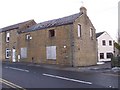


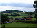

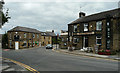
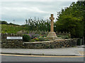
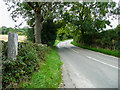

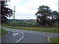
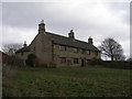
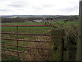
21 photos from this area
Area Information
Key information about the S35 7EE including its size, population, and administrative classification.
- Area Type
- Postcode
- Area Size
- 5.7 hectares
- Population
- 1651
- Population Density
- 194 people/km²
House Prices in S35 7EE
26
Properties
£260,629
Average Sold Price
£205,000
Lowest Price
£381,000
Highest Price
Showing 26 properties
| Address | Type | Beds | Baths | Last Sale Price | Last Sale Date | |
|---|---|---|---|---|---|---|
| 25 Hollin Moor View, Thurgoland, Barnsley, S35 7EE | Detached | 4 | 2 | £381,000 | Jan 2025 | |
| 14 Hollin Moor View, Thurgoland, Barnsley, S35 7EE | house | - | - | £265,000 | May 2021 | |
| 12 Hollin Moor View, Thurgoland, Barnsley, S35 7EE | Detached | 4 | 2 | £265,000 | Apr 2019 | |
| 18 Hollin Moor View, Thurgoland, Barnsley, S35 7EE | house | - | - | £270,000 | Oct 2016 | |
| 20 Hollin Moor View, Thurgoland, Barnsley, S35 7EE | Detached | 4 | 3 | £310,000 | Aug 2014 | |
| 21 Hollin Moor View, Thurgoland, Barnsley, S35 7EE | Detached | 4 | - | £230,000 | Mar 2014 | |
| 29 Hollin Moor View, Thurgoland, Barnsley, S35 7EE | Detached | 4 | - | £265,000 | Feb 2012 | |
| 31 Hollin Moor View, Thurgoland, Barnsley, S35 7EE | house | - | - | £294,000 | Nov 2011 | |
| 17 Hollin Moor View, Thurgoland, Barnsley, S35 7EE | house | 4 | - | £240,000 | Dec 2010 | |
| 41 Hollin Moor View, Thurgoland, Barnsley, S35 7EE | house | - | - | £230,000 | Oct 2010 |
Page 1 of 3
Energy Efficiency in S35 7EE
Amenities
Schools
| Rank | School | Type | Entry gender | Ages |
|---|
Explore more schools in this area
Go to Schools tabDemographics
Household Size
Two person
most common
Accommodation Type
Houses
most common
Tenure
71
majority
Ethnic Group
White
most common
Religion
N/A
most common
Household Composition
N/A
most common
Age
47
median
Adults (30-64 years)
most common
Household Deprivation
N/A
with no deprivation
NS-SEC
37
in Lower managerial occupations
Explore more demographic insights in this area
Go to Demographics tabPlanning
Planning Constraints
- Flood RiskPremium
- Ramsar Wetland SitesPremium
- Area of Outstanding Natural BeautyPremium
- Protected Nature ReservePremium
- Protected WoodlandPremium