Area Overview for S35 2ZP
Photos of S35 2ZP
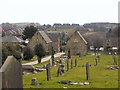
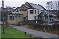
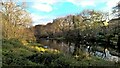
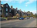
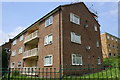
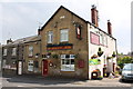
36 photos from this area
Area Information
Key information about the S35 2ZP including its size, population, and administrative classification.
- Area Type
- Postcode
- Area Size
- 1.2 hectares
- Population
- 1399
- Population Density
- 4942 people/km²
House Prices in S35 2ZP
33
Properties
£156,884
Average Sold Price
£44,500
Lowest Price
£530,000
Highest Price
Showing 33 properties
| Address | Type | Beds | Baths | Last Sale Price | Last Sale Date | |
|---|---|---|---|---|---|---|
| 62 Blackburn Drive, Sheffield, S35 2ZP | Detached | 4 | 3 | £530,000 | Aug 2023 | |
| 76 Blackburn Drive, Sheffield, S35 2ZP | Semi-detached | 3 | 1 | £225,000 | Apr 2022 | |
| 92 Blackburn Drive, Sheffield, S35 2ZP | Semi-detached | 2 | - | £127,500 | Aug 2016 | |
| 118 Blackburn Drive, Sheffield, S35 2ZP | Semi-detached | 3 | 1 | £135,000 | Aug 2014 | |
| 82 Blackburn Drive, Sheffield, S35 2ZP | Bungalow | 3 | - | £170,000 | May 2014 | |
| 126 Blackburn Drive, Sheffield, S35 2ZP | Semi-detached | 3 | - | £136,000 | Dec 2013 | |
| 122 Blackburn Drive, Sheffield, S35 2ZP | Semi-detached | 3 | - | £124,995 | Feb 2011 | |
| 84 Blackburn Drive, Sheffield, S35 2ZP | Bungalow | - | - | £152,500 | Sep 2009 | |
| 112 Blackburn Drive, Sheffield, S35 2ZP | house | - | - | £125,000 | May 2009 | |
| 88 Blackburn Drive, Sheffield, S35 2ZP | Semi-detached | - | - | £115,000 | Oct 2004 |
Page 1 of 4
Energy Efficiency in S35 2ZP
Amenities
Schools
| Rank | School | Type | Entry gender | Ages |
|---|
Explore more schools in this area
Go to Schools tabDemographics
Household Size
Two person
most common
Accommodation Type
Houses
most common
Tenure
68
majority
Ethnic Group
White
most common
Religion
N/A
most common
Household Composition
N/A
most common
Age
47
median
Adults (30-64 years)
most common
Household Deprivation
N/A
with no deprivation
NS-SEC
30
in Lower managerial occupations
Explore more demographic insights in this area
Go to Demographics tabPlanning
Planning Constraints
- Flood RiskPremium
- Ramsar Wetland SitesPremium
- Area of Outstanding Natural BeautyPremium
- Protected Nature ReservePremium
- Protected WoodlandPremium