Area Overview for S35 2UH
Photos of S35 2UH
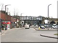
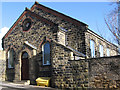
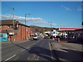
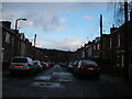
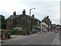
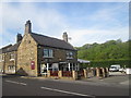
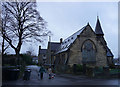


84 photos from this area
Area Information
Key information about the S35 2UH including its size, population, and administrative classification.
- Area Type
- Postcode
- Area Size
- 7752 m²
- Population
- 2735
- Population Density
- 1640 people/km²
House Prices in S35 2UH
38
Properties
£113,800
Average Sold Price
£22,000
Lowest Price
£230,000
Highest Price
Showing 38 properties
| Address | Type | Beds | Baths | Last Sale Price | Last Sale Date | |
|---|---|---|---|---|---|---|
| 145 Lane End, Sheffield, S35 2UH | Terraced | 4 | 1 | £155,000 | Nov 2022 | |
| 159 Lane End, Sheffield, S35 2UH | Terraced | 2 | 1 | £167,750 | Sep 2022 | |
| 125 Lane End, Sheffield, S35 2UH | Terraced | 3 | 1 | £140,000 | Aug 2021 | |
| 121 Lane End, Sheffield, S35 2UH | Terraced | 3 | 1 | £180,000 | Jun 2021 | |
| 149 Lane End, Sheffield, S35 2UH | Terraced | 3 | 1 | £115,000 | Nov 2020 | |
| 127 Lane End, Sheffield, S35 2UH | Terraced | 3 | 1 | £140,000 | Feb 2020 | |
| 119 Lane End, Sheffield, S35 2UH | Terraced | 3 | 1 | £145,000 | Aug 2019 | |
| 153 Lane End, Sheffield, S35 2UH | Terraced | 2 | 1 | £120,000 | Feb 2019 | |
| 131 Lane End, Sheffield, S35 2UH | Terraced | 3 | 1 | £105,000 | Nov 2017 | |
| 155 Lane End, Sheffield, S35 2UH | Terraced | 2 | - | £89,000 | Jul 2017 |
Page 1 of 4
Energy Efficiency in S35 2UH
Amenities
Schools
| Rank | School | Type | Entry gender | Ages |
|---|
Explore more schools in this area
Go to Schools tabDemographics
Household Size
Family (3-5 people)
most common
Accommodation Type
Houses
most common
Tenure
85
majority
Ethnic Group
White
most common
Religion
N/A
most common
Household Composition
N/A
most common
Age
47
median
Adults (30-64 years)
most common
Household Deprivation
N/A
with no deprivation
NS-SEC
36
in Lower managerial occupations
Explore more demographic insights in this area
Go to Demographics tabPlanning
Planning Constraints
- Flood RiskPremium
- Ramsar Wetland SitesPremium
- Area of Outstanding Natural BeautyPremium
- Protected Nature ReservePremium
- Protected WoodlandPremium