Area Overview for S35 0GD
Photos of S35 0GD
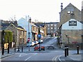
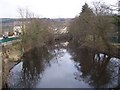
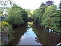
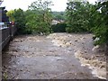
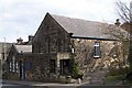
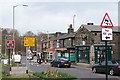
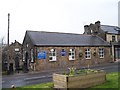
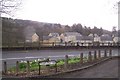
100 photos from this area
Area Information
Key information about the S35 0GD including its size, population, and administrative classification.
- Area Type
- Postcode
- Area Size
- 4.5 hectares
- Population
- 1868
- Population Density
- 3334 people/km²
House Prices in S35 0GD
50
Properties
£141,466
Average Sold Price
£31,200
Lowest Price
£265,000
Highest Price
Showing 50 properties
| Address | Type | Beds | Baths | Last Sale Price | Last Sale Date | |
|---|---|---|---|---|---|---|
| 62 Crag View Crescent, Sheffield, S35 0GD | Semi-detached | 3 | - | £265,000 | Jun 2025 | |
| 42 Crag View Crescent, Sheffield, S35 0GD | Semi-detached | 2 | 1 | £172,000 | Nov 2023 | |
| 88 Crag View Crescent, Sheffield, S35 0GD | Bungalow | 1 | 1 | £135,250 | Mar 2023 | |
| 8 Crag View Crescent, Sheffield, S35 0GD | Semi-detached | 2 | - | £165,000 | May 2021 | |
| 56 Crag View Crescent, Sheffield, S35 0GD | house | - | - | £200,711 | Jul 2018 | |
| 50 Crag View Crescent, Sheffield, S35 0GD | Semi-detached | 3 | 1 | £170,500 | Jun 2017 | |
| 22 Crag View Crescent, Sheffield, S35 0GD | Semi-detached | 2 | - | £136,000 | Sep 2015 | |
| 14 Crag View Crescent, Sheffield, S35 0GD | house | - | - | £155,000 | Jun 2015 | |
| 64 Crag View Crescent, Sheffield, S35 0GD | house | - | - | £124,950 | Dec 2011 | |
| 36 Crag View Crescent, Sheffield, S35 0GD | house | 3 | - | £155,000 | Nov 2011 |
Page 1 of 5
Energy Efficiency in S35 0GD
Amenities
Schools
| Rank | School | Type | Entry gender | Ages |
|---|
Explore more schools in this area
Go to Schools tabDemographics
Household Size
One person
most common
Accommodation Type
Houses
most common
Tenure
69
majority
Ethnic Group
White
most common
Religion
N/A
most common
Household Composition
N/A
most common
Age
47
median
Adults (30-64 years)
most common
Household Deprivation
N/A
with no deprivation
NS-SEC
41
in Lower managerial occupations
Explore more demographic insights in this area
Go to Demographics tabPlanning
Planning Constraints
- Flood RiskPremium
- Ramsar Wetland SitesPremium
- Area of Outstanding Natural BeautyPremium
- Protected Nature ReservePremium
- Protected WoodlandPremium