Area Overview for S31 0GW
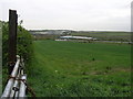
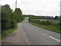
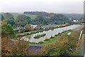
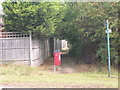
Photos of S31 0GW


Area Information
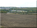
S31 0GW represents a specific postcode area covering a small residential cluster in England. You will find approximately 1,428 residents calling this neighbourhood home, creating a tight-knit community feel. With a population density of 376 people per square kilometre, the area is neither sprawling nor claustrophobic, offering a balanced living environment for those seeking a suburban or semi-urban setting. This cluster provides a distinct identity separate from larger towns, yet it benefits from proximity to wider networks. Daily life here is characterised by practicality and a strong sense of locality, where residents know one another. The area serves as a quiet residential base for those working in nearby industrial and commercial hubs. You experience the benefits of a defined neighbourhood without the overwhelming noise and congestion of larger urban centres. The compact nature of the postcode means you can navigate your local streets easily while maintaining access to essential services beyond your immediate doorstep. This environment suits families and professionals who value stability and a manageable commute over trendy city living.
- Area Type
- Postcode
- Area Size
- Not available
- Population
- 1428
- Population Density
- 376 people/km²
The property market in S31 0GW is strongly dominated by owner-occupied homes, reflecting the high level of resident attachment to the area. With 89% of households owning their properties, you will encounter a housing stock where owners have likely invested in their homes over the years. The predominant accommodation type is houses, which shapes the physical landscape of the postcode into a residential cluster of detached, semi-detached, and terraced family homes. This structure differs significantly from urban centre rentals, where landlords turnover properties frequently. Buyers looking for homes in S31 0GW encounter a market driven by primary residents rather than investors seeking short-term lets. The concentration of houses implies a layout suited to family life, with gardens and established gardens common in this small residential cluster. You can expect properties that have been maintained by current owners, resulting in a consistent standard of upkeep across the street. This ownership model also means transaction costs may relate to individual house sales rather than bulk block acquisitions typical of high-density rental zones.
House Prices in S31 0GW
No properties found in this postcode.
Energy Efficiency in S31 0GW
Living in S31 0GW places you within practical reach of essential amenities that form the commercial and transport heart of your daily routine. You have access to five retail outlets, including Asda Aston, Co-op Swallownest, and Aldi 81, ensuring your shopping needs are met with variety and convenience. For those commuting via train, five railway stations form your transport gateway, including Kiveton Bridge Railway Station, Woodhouse Railway Station, and Kiveton Park Railway Station. These stations offer easy access to wider networks, making your travel to work straightforward and predictable. Beyond rail, five metro stops serve the area, notably Beighton, Waterthorpe, and Westfield, providing alternative links to city centres or regional hubs. This combination of retail giants and transport nodes creates a self-sufficient lifestyle where you rarely feel isolated from the wider region. Your morning coffee, grocery run, or evening commute are all supported by these well-distributed facilities. The mix of supermarkets and rail links means you balance local convenience with regional accessibility effectively.
Amenities
Schools
| Rank | School | Type | Entry gender | Ages |
|---|
Explore more schools in this area
Go to Schools tabDemographics
The community in S31 0GW is defined by a mature demographic profile where adults aged between 30 and 64 years represent the most common age range. The median age of residents is 47 years old, indicating a neighbourhood dominated by established households rather than young singles or retirees. This age alignment reflects a stable population that has likely lived in the area for considerable periods. Home ownership stands at a remarkable 89%, suggesting that the vast majority of residents have purchased properties rather than renting. This high rate signifies long-term commitment to the location and financial stability among the local population. Most residents live in houses, which contributes to the family-oriented and suburban character of the postcode. While White residents form the predominant ethnic group, the high ownership rate often implies a cohesive community with shared interests and local traditions. This demographic mix creates a predictable and steady environment where social networks are well-established. You are likely to meet neighbours who have deep roots in the area, fostering a supportive atmosphere for local families.
Household Size
Accommodation Type
Tenure
Ethnic Group
Religion
Household Composition
Age
Household Deprivation
NS-SEC
Explore more demographic insights in this area
Go to Demographics tabPlanning
Planning Constraints
- Flood RiskPremium
- Ramsar Wetland SitesPremium
- Area of Outstanding Natural BeautyPremium
- Protected Nature ReservePremium
- Protected WoodlandPremium