Area Overview for S3 9JD
Photos of S3 9JD
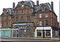
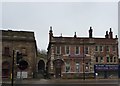
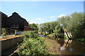
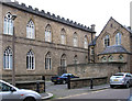
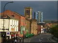
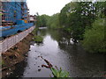
100 photos from this area
Area Information
Key information about the S3 9JD including its size, population, and administrative classification.
- Area Type
- Postcode
- Area Size
- 7013 m²
- Population
- 1811
- Population Density
- 6449 people/km²
House Prices in S3 9JD
33
Properties
£64,472
Average Sold Price
£12,000
Lowest Price
£139,000
Highest Price
Showing 33 properties
| Address | Type | Beds | Baths | Last Sale Price | Last Sale Date | |
|---|---|---|---|---|---|---|
| 144 Rock Street, Sheffield, S3 9JD | Terraced | 3 | 1 | £120,000 | May 2023 | |
| 160 Rock Street, Sheffield, S3 9JD | house | 4 | - | £80,000 | May 2021 | |
| 139 Rock Street, Sheffield, S3 9JD | Semi-detached | 3 | 2 | £75,000 | Mar 2018 | |
| 148 Rock Street, Sheffield, S3 9JD | house | - | - | £55,000 | Oct 2014 | |
| 146 Rock Street, Sheffield, S3 9JD | house | 4 | - | £75,000 | Nov 2012 | |
| 163 Rock Street, Sheffield, S3 9JD | house | - | - | £139,000 | Oct 2010 | |
| 167 Rock Street, Sheffield, S3 9JD | house | - | - | £136,000 | May 2008 | |
| 147 Rock Street, Sheffield, S3 9JD | Semi-detached | - | - | £115,000 | Nov 2007 | |
| 164 Rock Street, Sheffield, S3 9JD | house | - | - | £55,000 | Jun 2005 | |
| 158 Rock Street, Sheffield, S3 9JD | house | - | - | £53,000 | Mar 2005 |
Page 1 of 4
Energy Efficiency in S3 9JD
Amenities
Schools
| Rank | School | Type | Entry gender | Ages |
|---|
Explore more schools in this area
Go to Schools tabDemographics
Household Size
Family (3-5 people)
most common
Accommodation Type
Houses
most common
Tenure
32
majority
Ethnic Group
asian_total
most common
Religion
N/A
most common
Household Composition
N/A
most common
Age
22
median
Adults (30-64 years)
most common
Household Deprivation
N/A
with no deprivation
NS-SEC
12
in Lower managerial occupations
Explore more demographic insights in this area
Go to Demographics tabPlanning
Planning Constraints
- Flood RiskPremium
- Ramsar Wetland SitesPremium
- Area of Outstanding Natural BeautyPremium
- Protected Nature ReservePremium
- Protected WoodlandPremium