Area Overview for S26 5LB
Photos of S26 5LB
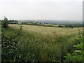
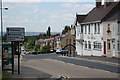
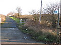
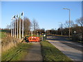
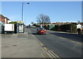
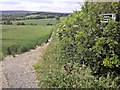
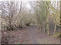
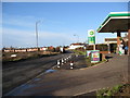
41 photos from this area
Area Information
Key information about the S26 5LB including its size, population, and administrative classification.
- Area Type
- Postcode
- Area Size
- 1.2 hectares
- Population
- 1606
- Population Density
- 244 people/km²
House Prices in S26 5LB
20
Properties
£170,500
Average Sold Price
£48,000
Lowest Price
£280,000
Highest Price
Showing 20 properties
| Address | Type | Beds | Baths | Last Sale Price | Last Sale Date | |
|---|---|---|---|---|---|---|
| 26 Almond Tree Road, Wales, Rotherham, S26 5LB | Bungalow | 2 | 1 | £210,000 | Jul 2025 | |
| 12 Almond Tree Road, Wales, Rotherham, S26 5LB | Bungalow | 3 | 1 | £280,000 | Jul 2024 | |
| 10 Almond Tree Road, Wales, Rotherham, S26 5LB | Bungalow | 3 | 1 | £261,000 | Jan 2024 | |
| 5 Almond Tree Road, Wales, Rotherham, S26 5LB | Semi-detached | 3 | 1 | £152,500 | May 2020 | |
| 30 Almond Tree Road, Wales, Rotherham, S26 5LB | Bungalow | 3 | - | £152,500 | Oct 2015 | |
| 24 Almond Tree Road, Wales, Rotherham, S26 5LB | Bungalow | - | - | £126,000 | Sep 2014 | |
| 7 Almond Tree Road, Wales, Rotherham, S26 5LB | house | - | - | £145,000 | May 2013 | |
| 6 Almond Tree Road, Wales, Rotherham, S26 5LB | Bungalow | - | - | £120,000 | Apr 2013 | |
| 28 Almond Tree Road, Wales, Rotherham, S26 5LB | Detached | - | - | £48,000 | Oct 2006 | |
| 2 Almond Tree Road, Wales, Rotherham, S26 5LB | Bungalow | 3 | - | £210,000 | Jul 2004 |
Page 1 of 2
Energy Efficiency in S26 5LB
Amenities
Schools
| Rank | School | Type | Entry gender | Ages |
|---|
Explore more schools in this area
Go to Schools tabDemographics
Household Size
Two person
most common
Accommodation Type
Houses
most common
Tenure
81
majority
Ethnic Group
White
most common
Religion
N/A
most common
Household Composition
N/A
most common
Age
47
median
Adults (30-64 years)
most common
Household Deprivation
N/A
with no deprivation
NS-SEC
32
in Lower managerial occupations
Explore more demographic insights in this area
Go to Demographics tabPlanning
Planning Constraints
- Flood RiskPremium
- Ramsar Wetland SitesPremium
- Area of Outstanding Natural BeautyPremium
- Protected Nature ReservePremium
- Protected WoodlandPremium