Area Overview for S26 2GN
Photos of S26 2GN
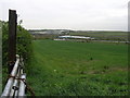
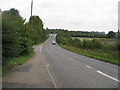
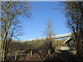
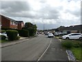

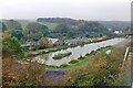
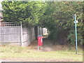
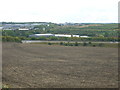
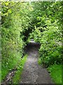
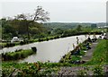
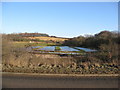
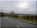
14 photos from this area
Area Information
Key information about the S26 2GN including its size, population, and administrative classification.
- Area Type
- Postcode
- Area Size
- 6882 m²
- Population
- 2100
- Population Density
- 1105 people/km²
House Prices in S26 2GN
23
Properties
£158,246
Average Sold Price
£58,250
Lowest Price
£230,000
Highest Price
Showing 23 properties
| Address | Type | Beds | Baths | Last Sale Price | Last Sale Date | |
|---|---|---|---|---|---|---|
| 5 Bluebird Hill, Aston, Rotherham, S26 2GN | Semi-detached | 3 | 1 | £230,000 | Jul 2024 | |
| 20 Bluebird Hill, Aston, Rotherham, S26 2GN | Semi-detached | - | - | £212,000 | Dec 2021 | |
| 9 Bluebird Hill, Aston, Rotherham, S26 2GN | house | - | - | £195,000 | Apr 2021 | |
| 12 Bluebird Hill, Aston, Rotherham, S26 2GN | house | - | - | £188,000 | Feb 2021 | |
| 19 Bluebird Hill, Aston, Rotherham, S26 2GN | house | 3 | 1 | £168,000 | Jan 2020 | |
| 18 Bluebird Hill, Aston, Rotherham, S26 2GN | Semi-detached | 3 | 2 | £150,000 | Sep 2015 | |
| 14 Bluebird Hill, Aston, Rotherham, S26 2GN | Bungalow | - | - | £172,000 | Mar 2015 | |
| 21 Bluebird Hill, Aston, Rotherham, S26 2GN | Semi-detached | 3 | 1 | £123,500 | Nov 2013 | |
| 11 Bluebird Hill, Aston, Rotherham, S26 2GN | Semi-detached | 3 | 1 | £121,000 | Jan 2012 | |
| 6 Bluebird Hill, Aston, Rotherham, S26 2GN | Semi-detached | 3 | 1 | £103,200 | Mar 2009 |
Page 1 of 3
Energy Efficiency in S26 2GN
Amenities
Schools
| Rank | School | Type | Entry gender | Ages |
|---|
Explore more schools in this area
Go to Schools tabDemographics
Household Size
Family (3-5 people)
most common
Accommodation Type
Houses
most common
Tenure
88
majority
Ethnic Group
White
most common
Religion
N/A
most common
Household Composition
N/A
most common
Age
47
median
Adults (30-64 years)
most common
Household Deprivation
N/A
with no deprivation
NS-SEC
36
in Lower managerial occupations
Explore more demographic insights in this area
Go to Demographics tabPlanning
Planning Constraints
- Flood RiskPremium
- Ramsar Wetland SitesPremium
- Area of Outstanding Natural BeautyPremium
- Protected Nature ReservePremium
- Protected WoodlandPremium