Area Overview for S26 2BY
Photos of S26 2BY
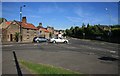
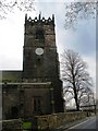

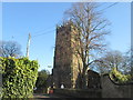


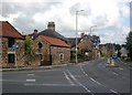
26 photos from this area
Area Information
Key information about the S26 2BY including its size, population, and administrative classification.
- Area Type
- Postcode
- Area Size
- 1.7 hectares
- Population
- 1447
- Population Density
- 1712 people/km²
House Prices in S26 2BY
30
Properties
£149,494
Average Sold Price
£46,000
Lowest Price
£254,000
Highest Price
Showing 30 properties
| Address | Type | Beds | Baths | Last Sale Price | Last Sale Date | |
|---|---|---|---|---|---|---|
| 28 Osborne Avenue, Aston, Rotherham, S26 2BY | Bungalow | 2 | 1 | £237,000 | Mar 2025 | |
| 24 Osborne Avenue, Aston, Rotherham, S26 2BY | Bungalow | 2 | - | £240,000 | May 2024 | |
| 30 Osborne Avenue, Aston, Rotherham, S26 2BY | Retail | 3 | 1 | £254,000 | Sep 2022 | |
| 18 Osborne Avenue, Aston, Rotherham, S26 2BY | Bungalow | 2 | 1 | £198,000 | Dec 2020 | |
| 20 Osborne Avenue, Aston, Rotherham, S26 2BY | Bungalow | - | - | £190,000 | Nov 2018 | |
| 22 Osborne Avenue, Aston, Rotherham, S26 2BY | Bungalow | - | - | £166,500 | Jan 2016 | |
| 4 Osborne Avenue, Aston, Rotherham, S26 2BY | Bungalow | 2 | - | £105,000 | Nov 2013 | |
| The Grove, 29 Osborne Avenue, Aston, Rotherham, S26 2BY | Bungalow | 3 | - | £185,000 | May 2012 | |
| 19 Osborne Avenue, Aston, Rotherham, S26 2BY | Bungalow | - | - | £134,000 | Jul 2011 | |
| 6 Osborne Avenue, Aston, Rotherham, S26 2BY | Semi-detached | - | - | £120,000 | Mar 2008 |
Page 1 of 3
Energy Efficiency in S26 2BY
Amenities
Schools
| Rank | School | Type | Entry gender | Ages |
|---|
Explore more schools in this area
Go to Schools tabDemographics
Household Size
Two person
most common
Accommodation Type
Houses
most common
Tenure
85
majority
Ethnic Group
White
most common
Religion
N/A
most common
Household Composition
N/A
most common
Age
47
median
Adults (30-64 years)
most common
Household Deprivation
N/A
with no deprivation
NS-SEC
30
in Lower managerial occupations
Explore more demographic insights in this area
Go to Demographics tabPlanning
Planning Constraints
- Flood RiskPremium
- Ramsar Wetland SitesPremium
- Area of Outstanding Natural BeautyPremium
- Protected Nature ReservePremium
- Protected WoodlandPremium