Area Overview for S25 5HT
Photos of S25 5HT

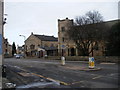

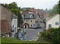
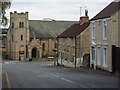
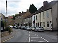

39 photos from this area
Area Information
Key information about the S25 5HT including its size, population, and administrative classification.
- Area Type
- Postcode
- Area Size
- 1.4 hectares
- Population
- 1471
- Population Density
- 482 people/km²
House Prices in S25 5HT
24
Properties
£187,650
Average Sold Price
£72,000
Lowest Price
£297,500
Highest Price
Showing 24 properties
| Address | Type | Beds | Baths | Last Sale Price | Last Sale Date | |
|---|---|---|---|---|---|---|
| 18 West Bank Drive, South Anston, Rotherham, S25 5HT | Detached | 4 | 2 | £297,500 | Aug 2022 | |
| 21 West Bank Drive, South Anston, Rotherham, S25 5HT | Detached | 3 | 1 | £250,000 | Feb 2022 | |
| 12 West Bank Drive, South Anston, Rotherham, S25 5HT | Detached | 4 | 1 | £275,000 | May 2019 | |
| 8 West Bank Drive, South Anston, Rotherham, S25 5HT | Detached | 4 | - | £220,000 | Aug 2017 | |
| 20 West Bank Drive, South Anston, Rotherham, S25 5HT | Detached | 4 | 1 | £195,000 | Dec 2016 | |
| 22 West Bank Drive, South Anston, Rotherham, S25 5HT | Detached | 4 | 2 | £219,950 | May 2014 | |
| 23 West Bank Drive, South Anston, Rotherham, S25 5HT | house | - | - | £195,000 | Jun 2012 | |
| 10 West Bank Drive, South Anston, Rotherham, S25 5HT | Detached | - | - | £243,000 | Jan 2010 | |
| 27 West Bank Drive, South Anston, Rotherham, S25 5HT | house | - | - | £210,000 | Apr 2006 | |
| 13 West Bank Drive, South Anston, Rotherham, S25 5HT | Detached | 4 | - | £80,000 | Jul 2000 |
Page 1 of 3
Energy Efficiency in S25 5HT
Amenities
Schools
| Rank | School | Type | Entry gender | Ages |
|---|
Explore more schools in this area
Go to Schools tabDemographics
Household Size
Two person
most common
Accommodation Type
Houses
most common
Tenure
83
majority
Ethnic Group
White
most common
Religion
N/A
most common
Household Composition
N/A
most common
Age
47
median
Adults (30-64 years)
most common
Household Deprivation
N/A
with no deprivation
NS-SEC
43
in Lower managerial occupations
Explore more demographic insights in this area
Go to Demographics tabPlanning
Planning Constraints
- Flood RiskPremium
- Ramsar Wetland SitesPremium
- Area of Outstanding Natural BeautyPremium
- Protected Nature ReservePremium
- Protected WoodlandPremium