Area Overview for S25 4BU
Photos of S25 4BU
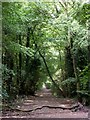
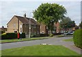
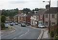
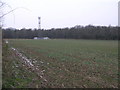
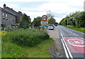
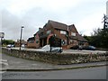
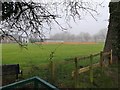
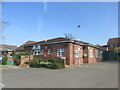
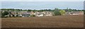
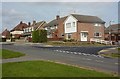
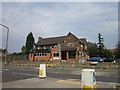
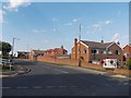
17 photos from this area
Area Information
Key information about the S25 4BU including its size, population, and administrative classification.
- Area Type
- Postcode
- Area Size
- 1.8 hectares
- Population
- 1452
- Population Density
- 523 people/km²
House Prices in S25 4BU
34
Properties
£117,519
Average Sold Price
£43,500
Lowest Price
£190,000
Highest Price
Showing 34 properties
| Address | Type | Beds | Baths | Last Sale Price | Last Sale Date | |
|---|---|---|---|---|---|---|
| 28 Nursery Road, North Anston, Rotherham, S25 4BU | Semi-detached | 2 | 1 | £138,000 | Jan 2025 | |
| 20 Nursery Road, North Anston, Rotherham, S25 4BU | Detached | 3 | 1 | £125,000 | Jul 2024 | |
| 16 Nursery Road, North Anston, Rotherham, S25 4BU | Semi-detached | 2 | 1 | £150,000 | Jan 2024 | |
| 4 Nursery Road, North Anston, Rotherham, S25 4BU | Semi-detached | 4 | - | £163,800 | Oct 2020 | |
| 22 Nursery Road, North Anston, Rotherham, S25 4BU | Semi-detached | 2 | 1 | £127,500 | Oct 2020 | |
| 18 Nursery Road, North Anston, Rotherham, S25 4BU | Semi-detached | 4 | 2 | £160,000 | Jun 2020 | |
| 30 Nursery Road, North Anston, Rotherham, S25 4BU | Semi-detached | 3 | 1 | £146,000 | Oct 2019 | |
| 44 Nursery Road, North Anston, Rotherham, S25 4BU | Semi-detached | 3 | 1 | £91,500 | Mar 2016 | |
| 38 NURSERY ROAD, North Anston, Rotherham, S25 4BU | Detached | 4 | - | £120,000 | Mar 2016 | |
| 60 Nursery Road, North Anston, Rotherham, S25 4BU | Semi-detached | - | - | £120,000 | Dec 2013 |
Page 1 of 4
Energy Efficiency in S25 4BU
Amenities
Schools
| Rank | School | Type | Entry gender | Ages |
|---|
Explore more schools in this area
Go to Schools tabDemographics
Household Size
Two person
most common
Accommodation Type
Houses
most common
Tenure
83
majority
Ethnic Group
White
most common
Religion
N/A
most common
Household Composition
N/A
most common
Age
47
median
Adults (30-64 years)
most common
Household Deprivation
N/A
with no deprivation
NS-SEC
36
in Lower managerial occupations
Explore more demographic insights in this area
Go to Demographics tabPlanning
Planning Constraints
- Flood RiskPremium
- Ramsar Wetland SitesPremium
- Area of Outstanding Natural BeautyPremium
- Protected Nature ReservePremium
- Protected WoodlandPremium