Area Overview for S25 2LZ
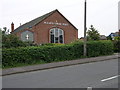
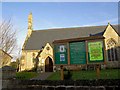
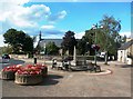
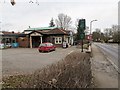
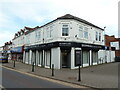
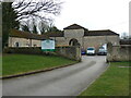
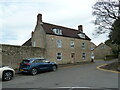
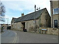
Photos of S25 2LZ
Area Information
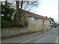
Living in S25 2LZ offers a settled residential experience within a compact footprint. This specific postcode cluster covers just 968 square metres yet supports a population of 1,240 people. The high population density reflects a tightly built environment where neighbours are often close by. Daily life here revolves around a dense, established community rather than sprawling development. You will find a normal residential rhythm without the chaos of major commercial hubs. The area functions as a self-contained pocket of housing where most activity occurs locally. Residents benefit from living in a space that feels established but remains residential in nature. The character of S25 2LZ is defined by its exclusivity as a small cluster within a wider region. There are no large industrial parks or major transport nodes directly on the doorstep, ensuring a quiet domestic setting. The area size is small enough to manage quickly on foot while remaining distinct from neighbouring zones. This layout makes practical navigation simple for those settled within these boundaries. Your week involves interacting with a concentrated community where services are accessible yet housed settings retain their privacy.
- Area Type
- Postcode
- Area Size
- 968 m²
- Population
- 1240
- Population Density
- 2684 people/km²
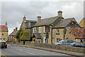
The property market in S25 2LZ is defined by ownership rather than renting. With a home ownership rate of 91 per cent, this area functions primarily as a market for existing owners looking to move or upgrade. The accommodation type consists entirely of houses, which aligns with the preference for traditional family living found throughout the postcode. This means you are dealing with brick-and-mortor family homes rather than modern apartments or studio flats. The high proportion of owner-occupied properties suggests a stable market where speculation is low and residents stay for the long term. Buyers looking at homes in S25 2LZ are likely entering an environment where sellers have deep knowledge of the street values and local history. The housing stock is not mixed with student lets or corporate housing units. Instead, the market reflects local families passing on properties within the same cluster. This creates a predictable market environment where prices tend to move with regional trends rather than urban fluctuations. The absence of rental units further simplifies the purchase process for those seeking a permanent residence.
House Prices in S25 2LZ
No properties found in this postcode.
Energy Efficiency in S25 2LZ
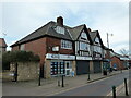
Resident lifestyle in S25 2LZ centres on convenient access to essential retail and rail links. You have five notable retail options nearby, including Aldi Throapham, Heron Throapham, and Tesco Sheffield. These supermarkets provide daily groceries and household essentials within practical reach of your front door. For train commuters, the area backs onto three key railway stations: Kiveton Park, Kiveton Bridge, and Shireoaks. This rail connectivity allows you to access wider employment centres without being trapped in local traffic patterns. Additionally, the Clacks network reaches five metro points: Beighton, Waterthorpe, and Westfield. These additional transport nodes offer flexible scheduling options for your daily journey to work or school. You will find that your weekly shop is a short drive or bus ride away, reducing the need for a large car. The presence of Heron Throapham specifically adds a local touch to your retail routine, offering neighbourhood shopping alongside the larger supermarkets. Your time is saved by having these amenities clustered logically near your home.
Amenities
Schools
| Rank | School | Type | Entry gender | Ages |
|---|
Explore more schools in this area
Go to Schools tabDemographics
The community within S25 2LZ displays a clear preference for stability and established family life. The median age sits at 47 years, indicating a mature resident base who have settled long-term. Adults aged between 30 and 64 years constitute the most common age range in the area. This demographic profile suggests a neighbourhood dominated by working families and retired professionals rather than young students or transient workers. Home ownership reaches an impressive 91 per cent, showing that most houses in S25 2LZ are owned outright or with long-term mortgages. This high rate signals a desire for permanence among locals and reduces the presence of short-term rentals. The accommodation type is exclusively houses, meaning you will not find any flats in this specific postcode. The demographic makeup is predominantly White, reflecting the traditional settlement patterns of this part of England. These figures paint a picture of a homogenous, family-oriented environment where residents value stability. Deprivation levels are not explicitly detailed in current records, but the high ownership rates often correlate with wealthier neighbourhoods. You are looking at a community where long-term residents have built deep roots in local schools and social groups.
Household Size
Accommodation Type
Tenure
Ethnic Group
Religion
Household Composition
Age
Household Deprivation
NS-SEC
Explore more demographic insights in this area
Go to Demographics tabPlanning
Planning Constraints
- Flood RiskPremium
- Ramsar Wetland SitesPremium
- Area of Outstanding Natural BeautyPremium
- Protected Nature ReservePremium
- Protected WoodlandPremium