Area Overview for S25 1YL
Photos of S25 1YL
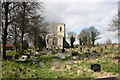
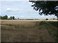
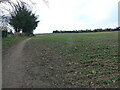
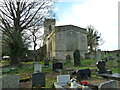
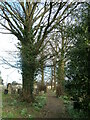
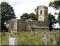
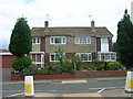
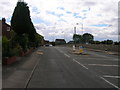

15 photos from this area
Area Information
Key information about the S25 1YL including its size, population, and administrative classification.
- Area Type
- Postcode
- Area Size
- 8.0 hectares
- Population
- 1580
- Population Density
- 597 people/km²
House Prices in S25 1YL
44
Properties
£134,773
Average Sold Price
£31,000
Lowest Price
£550,000
Highest Price
Showing 44 properties
| Address | Type | Beds | Baths | Last Sale Price | Last Sale Date | |
|---|---|---|---|---|---|---|
| 15 St Johns Road, Laughton En Le Morthen, Rotherham, S25 1YL | Bungalow | 4 | 2 | £550,000 | May 2025 | |
| 47 St Johns Road, Laughton En Le Morthen, Rotherham, S25 1YL | Terraced | 3 | 2 | £145,000 | Apr 2025 | |
| 61 St Johns Road, Laughton En Le Morthen, Rotherham, S25 1YL | house | 2 | 1 | £165,000 | Oct 2024 | |
| 45 St Johns Road, Laughton En Le Morthen, Rotherham, S25 1YL | Terraced | 3 | 1 | £125,000 | Apr 2024 | |
| 51 St Johns Road, Laughton En Le Morthen, Rotherham, S25 1YL | Terraced | 2 | 1 | £128,000 | Dec 2023 | |
| 11 St Johns Road, Laughton En Le Morthen, Rotherham, S25 1YL | Terraced | 2 | 1 | £217,500 | Oct 2023 | |
| 63A St Johns Road, Laughton En Le Morthen, Rotherham, S25 1YL | house | - | - | £116,800 | Sep 2023 | |
| 49 St Johns Road, Laughton En Le Morthen, Rotherham, S25 1YL | Terraced | 3 | - | £160,000 | Dec 2022 | |
| 55A St Johns Road, Laughton En Le Morthen, Rotherham, S25 1YL | Semi-detached | 2 | 1 | £171,000 | Sep 2022 | |
| 81 St Johns Road, Laughton En Le Morthen, Rotherham, S25 1YL | Terraced | 4 | 1 | £135,000 | Jul 2018 |
Page 1 of 5
Energy Efficiency in S25 1YL
Amenities
Schools
| Rank | School | Type | Entry gender | Ages |
|---|
Explore more schools in this area
Go to Schools tabDemographics
Household Size
One person
most common
Accommodation Type
Houses
most common
Tenure
53
majority
Ethnic Group
White
most common
Religion
N/A
most common
Household Composition
N/A
most common
Age
47
median
Adults (30-64 years)
most common
Household Deprivation
N/A
with no deprivation
NS-SEC
20
in Lower managerial occupations
Explore more demographic insights in this area
Go to Demographics tabPlanning
Planning Constraints
- Flood RiskPremium
- Ramsar Wetland SitesPremium
- Area of Outstanding Natural BeautyPremium
- Protected Nature ReservePremium
- Protected WoodlandPremium