Area Overview for S20 8LT
Photos of S20 8LT
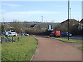
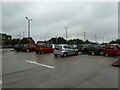
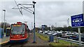
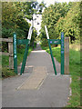
46 photos from this area
Area Information
Key information about the S20 8LT including its size, population, and administrative classification.
- Area Type
- Postcode
- Area Size
- 1.0 hectares
- Population
- 1782
- Population Density
- 1686 people/km²
House Prices in S20 8LT
24
Properties
£82,039
Average Sold Price
£5,442
Lowest Price
£117,500
Highest Price
Showing 24 properties
| Address | Type | Beds | Baths | Last Sale Price | Last Sale Date | |
|---|---|---|---|---|---|---|
| 4 Waterthorpe Close, Sheffield, S20 8LT | Semi-detached | 3 | 1 | £5,442 | Jan 2020 | |
| 14 Waterthorpe Close, Sheffield, S20 8LT | house | 3 | - | £90,000 | Jun 2015 | |
| 7 Waterthorpe Close, Sheffield, S20 8LT | house | - | - | £81,000 | Dec 2014 | |
| 22 Waterthorpe Close, Sheffield, S20 8LT | Semi-detached | 3 | 1 | £85,000 | Nov 2013 | |
| 18 Waterthorpe Close, Sheffield, S20 8LT | house | - | - | £102,000 | Jun 2010 | |
| 9 Waterthorpe Close, Sheffield, S20 8LT | house | 3 | 1 | £117,500 | Jan 2008 | |
| 10 Waterthorpe Close, Sheffield, S20 8LT | Terraced | - | - | £100,000 | Oct 2006 | |
| 19 Waterthorpe Close, Sheffield, S20 8LT | Terraced | - | - | £103,500 | Sep 2006 | |
| 17 Waterthorpe Close, Sheffield, S20 8LT | Terraced | 3 | 1 | £69,950 | Aug 2003 | |
| 12 Waterthorpe Close, Sheffield, S20 8LT | house | - | - | £66,000 | Nov 2002 |
Page 1 of 3
Energy Efficiency in S20 8LT
Amenities
Schools
| Rank | School | Type | Entry gender | Ages |
|---|
Explore more schools in this area
Go to Schools tabDemographics
Household Size
Family (3-5 people)
most common
Accommodation Type
Houses
most common
Tenure
64
majority
Ethnic Group
White
most common
Religion
N/A
most common
Household Composition
N/A
most common
Age
47
median
Adults (30-64 years)
most common
Household Deprivation
N/A
with no deprivation
NS-SEC
24
in Lower managerial occupations
Explore more demographic insights in this area
Go to Demographics tabPlanning
Planning Constraints
- Flood RiskPremium
- Ramsar Wetland SitesPremium
- Area of Outstanding Natural BeautyPremium
- Protected Nature ReservePremium
- Protected WoodlandPremium