Area Overview for S2 5PD
Photos of S2 5PD

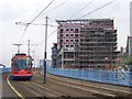


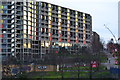
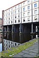
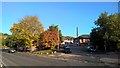


100 photos from this area
Area Information
Key information about the S2 5PD including its size, population, and administrative classification.
- Area Type
- Postcode
- Area Size
- 7354 m²
- Population
- 2674
- Population Density
- 2934 people/km²
House Prices in S2 5PD
23
Properties
£74,797
Average Sold Price
£26,950
Lowest Price
£133,501
Highest Price
Showing 23 properties
| Address | Type | Beds | Baths | Last Sale Price | Last Sale Date | |
|---|---|---|---|---|---|---|
| 17 Bard Street, Sheffield, S2 5PD | Flat | - | - | £93,000 | Nov 2024 | |
| 16 Bard Street, Sheffield, S2 5PD | Flat | 1 | 1 | £95,000 | Jun 2024 | |
| 3 Bard Street, Sheffield, S2 5PD | Terraced | 2 | 1 | £133,501 | Aug 2023 | |
| 20 Bard Street, Sheffield, S2 5PD | Flat | - | - | £86,000 | Sep 2022 | |
| 25 Bard Street, Sheffield, S2 5PD | Flat | - | - | £78,500 | Aug 2019 | |
| 14 Bard Street, Sheffield, S2 5PD | Flat | - | - | £71,500 | Mar 2019 | |
| 9 Bard Street, Sheffield, S2 5PD | Flat | - | - | £80,000 | Dec 2017 | |
| 5 Bard Street, Sheffield, S2 5PD | Terraced | 2 | 1 | £107,000 | Jun 2016 | |
| 10 Bard Street, Sheffield, S2 5PD | Flat | 1 | - | £60,000 | Oct 2014 | |
| 1 Bard Street, Sheffield, S2 5PD | Terraced | 2 | - | £75,000 | Aug 2013 |
Page 1 of 3
Energy Efficiency in S2 5PD
Amenities
Schools
| Rank | School | Type | Entry gender | Ages |
|---|
Explore more schools in this area
Go to Schools tabDemographics
Household Size
One person
most common
Accommodation Type
Flats
most common
Tenure
25
majority
Ethnic Group
White
most common
Religion
N/A
most common
Household Composition
N/A
most common
Age
22
median
Young Adults (15-29 years)
most common
Household Deprivation
N/A
with no deprivation
NS-SEC
22
in Lower managerial occupations
Explore more demographic insights in this area
Go to Demographics tabPlanning
Planning Constraints
- Flood RiskPremium
- Ramsar Wetland SitesPremium
- Area of Outstanding Natural BeautyPremium
- Protected Nature ReservePremium
- Protected WoodlandPremium