Area Overview for S2 3AT
Photos of S2 3AT
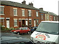
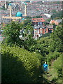
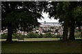
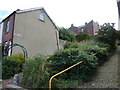
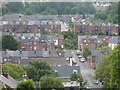
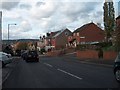
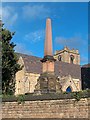
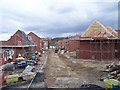
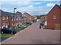
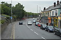
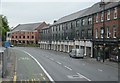
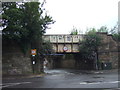
100 photos from this area
Area Information
Key information about the S2 3AT including its size, population, and administrative classification.
- Area Type
- Postcode
- Area Size
- 5125 m²
- Population
- 1389
- Population Density
- 4180 people/km²
House Prices in S2 3AT
20
Properties
£99,458
Average Sold Price
£31,000
Lowest Price
£158,500
Highest Price
Showing 20 properties
| Address | Type | Beds | Baths | Last Sale Price | Last Sale Date | |
|---|---|---|---|---|---|---|
| 87 Northcote Road, Sheffield, S2 3AT | Semi-detached | 2 | 2 | £150,000 | Jul 2025 | |
| 75 Northcote Road, Sheffield, S2 3AT | Semi-detached | 3 | - | £158,500 | Jun 2018 | |
| 71 Northcote Road, Sheffield, S2 3AT | Semi-detached | 2 | 1 | £86,000 | Aug 2014 | |
| 63 Northcote Road, Sheffield, S2 3AT | Semi-detached | 2 | 1 | £133,000 | May 2014 | |
| 59 Northcote Road, Sheffield, S2 3AT | Detached | 3 | 1 | £140,000 | May 2013 | |
| 65 Northcote Road, Sheffield, S2 3AT | house | - | - | £123,000 | Mar 2010 | |
| 79 Northcote Road, Sheffield, S2 3AT | Semi-detached | - | - | £121,500 | Dec 2007 | |
| 61 Northcote Road, Sheffield, S2 3AT | Semi-detached | - | - | £104,500 | May 2007 | |
| 69 Northcote Road, Sheffield, S2 3AT | Semi-detached | - | - | £72,000 | Nov 2002 | |
| 89 Northcote Road, Sheffield, S2 3AT | house | - | - | £40,000 | Sep 1999 |
Page 1 of 2
Energy Efficiency in S2 3AT
Amenities
Schools
| Rank | School | Type | Entry gender | Ages |
|---|
Explore more schools in this area
Go to Schools tabDemographics
Household Size
One person
most common
Accommodation Type
Houses
most common
Tenure
60
majority
Ethnic Group
White
most common
Religion
N/A
most common
Household Composition
N/A
most common
Age
47
median
Adults (30-64 years)
most common
Household Deprivation
N/A
with no deprivation
NS-SEC
36
in Lower managerial occupations
Explore more demographic insights in this area
Go to Demographics tabPlanning
Planning Constraints
- Flood RiskPremium
- Ramsar Wetland SitesPremium
- Area of Outstanding Natural BeautyPremium
- Protected Nature ReservePremium
- Protected WoodlandPremium