Area Overview for S2 1FB
Photos of S2 1FB
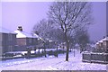
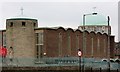
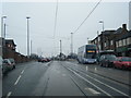
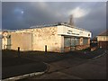
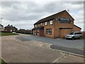
40 photos from this area
Area Information
Key information about the S2 1FB including its size, population, and administrative classification.
- Area Type
- Postcode
- Area Size
- 9525 m²
- Population
- 1871
- Population Density
- 5404 people/km²
House Prices in S2 1FB
17
Properties
£85,599
Average Sold Price
£40,000
Lowest Price
£147,000
Highest Price
Showing 17 properties
| Address | Type | Beds | Baths | Last Sale Price | Last Sale Date | |
|---|---|---|---|---|---|---|
| 195 Prince Of Wales Road, Sheffield, S2 1FB | Semi-detached | 3 | 1 | £147,000 | Sep 2023 | |
| 221 Prince Of Wales Road, Sheffield, S2 1FB | Terraced | 3 | 1 | £90,000 | Oct 2019 | |
| 197 Prince Of Wales Road, Sheffield, S2 1FB | Semi-detached | 3 | - | £61,000 | Jun 2015 | |
| 193 Prince Of Wales Road, Sheffield, S2 1FB | Semi-detached | - | - | £89,995 | Jan 2007 | |
| 191 Prince Of Wales Road, Sheffield, S2 1FB | house | - | - | £40,000 | Jun 2005 | |
| 225 Prince Of Wales Road, Sheffield, S2 1FB | Detached | 3 | 1 | - | - | |
| 207 Prince Of Wales Road, Sheffield, S2 1FB | Terraced | - | - | - | - | |
| 219 Prince Of Wales Road, Sheffield, S2 1FB | house | - | - | - | - | |
| 209 Prince Of Wales Road, Sheffield, S2 1FB | house | - | - | - | - | |
| 203 Prince Of Wales Road, Sheffield, S2 1FB | house | - | - | - | - |
Page 1 of 2
Energy Efficiency in S2 1FB
Amenities
Schools
| Rank | School | Type | Entry gender | Ages |
|---|
Explore more schools in this area
Go to Schools tabDemographics
Household Size
Family (3-5 people)
most common
Accommodation Type
Houses
most common
Tenure
31
majority
Ethnic Group
White
most common
Religion
N/A
most common
Household Composition
N/A
most common
Age
47
median
Adults (30-64 years)
most common
Household Deprivation
N/A
with no deprivation
NS-SEC
15
in Lower managerial occupations
Explore more demographic insights in this area
Go to Demographics tabPlanning
Planning Constraints
- Flood RiskPremium
- Ramsar Wetland SitesPremium
- Area of Outstanding Natural BeautyPremium
- Protected Nature ReservePremium
- Protected WoodlandPremium