Area Overview for S19 6DE
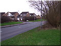
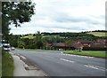
Photos of S19 6DE


Area Information
Living in S19 6DE means residing in a small, tightly clustered residential postcode in England. You are part of a tight-knit community with a total population of 2183 people. The area packs a significant density, recording 1913 people per square kilometre. This figure indicates a mature settlement where houses are situated relatively close to one another. You will find a population dominated by adults aged between 30 and 64 years. This age range represents the most common demographic in the neighbourhood. The environment consists almost entirely of houses rather than high-rise flats or purpose-built blocks. The character of S19 6DE is defined by established home ownership and a stable residential mix. There are no protected nature reserves, woodlands, or Areas of Outstanding Natural Beauty within the immediate boundaries. You also do not need to worry about Ramsar wetland sites or flood risks affecting your property. Instead, safety plays the largest role in the area's planning landscape. The location offers a practical living space where daily routine revolves around neighbours and local established facilities.
- Area Type
- Postcode
- Area Size
- Not available
- Population
- 2183
- Population Density
- 1913 people/km²
The property market in S19 6DE is distinctively owner-focused and static. With home ownership levels reaching 77%, you are looking at a post where sellers have significant equity and residency stability. The accommodation type is strictly houses, meaning you will not find flats or purpose-built apartments for rent or sale in this specific postcode. This structure creates a market driven by detached or semi-detached family properties. The density of 1913 people per square kilometre implies a compact village feel rather than sprawling suburban streets. You will find properties suited to those seeking a permanent lifestyle rather than a rental arrangement. Landlords rarely operate here because the 77% ownership rate leaves little room for buy-to-let schemes. The housing stock reflects a mature market where price fluctuations may be subdued by stable demand from locals. If you hunt for homes in S19 6DE, expect traditional architecture and established neighbourhoods. The market does not cater to the student or young professional demographic looking for modern flats. Instead, it serves residents prioritising a rooted existence in a residential cluster of houses.
House Prices in S19 6DE
No properties found in this postcode.
Energy Efficiency in S19 6DE
Your daily life in S19 6DE is supported by a cluster of nearest amenities within practical reach. You have access to five notable metro points, including Crystal Peaks, Moss Way, and Donetsk Way. Retail needs are met by five key shops in your immediate vicinity. You can visit Iceland Crystal and Sainsburys Crystal for weekly groceries, or travel to Asda Sheffield for larger bulk purchases. There are also five railway stations nearby, including Woodhouse, Kiveton Bridge, and Darnall Railway Stations, offering clear transport links if you need to travel further afield. While the local area focuses on residential living, these five retail outlets and transport hubs ensure you do not need to travel far for essentials. The presence of specific named venues like Donetsk Way and Crystal Peaks indicates a developed local infrastructure. These amenities form a convenient web of services around your home. You access them without requiring long commutes to city centres. The layout supports a self-sufficient lifestyle where shops and stations are close by.
Amenities
Schools
| Rank | School | Type | Entry gender | Ages |
|---|
Explore more schools in this area
Go to Schools tabDemographics
The community in S19 6DE is characterised by a settled adult population. The median age sits at 47 years, confirming that adults between 30 and 64 years old form the core of the neighbourhood. This age profile suggests a mix of established families and empty nesters rather than young professionals or students. Home ownership is remarkably high in this postcode, standing at 77%. This statistic confirms that the vast majority of residents own their homes outright or have a significant equity stake. Consequently, S19 6DE functions as a wealthy, owner-occupied estate rather than a rental hub. The accommodation type is exclusively houses, removing the presence of apartments or flats from the local scene. The predominant ethnic group is White, reflecting the traditional demographic make-up of this specific rural or semi-rural cluster. You will not find large transient populations or temporary housing blocks here. The area describes a quiet, family-oriented environment where long-term residents dominate the streets. Stability is the defining feature of this community structure.
Household Size
Accommodation Type
Tenure
Ethnic Group
Religion
Household Composition
Age
Household Deprivation
NS-SEC
Explore more demographic insights in this area
Go to Demographics tabPlanning
Planning Constraints
- Flood RiskPremium
- Ramsar Wetland SitesPremium
- Area of Outstanding Natural BeautyPremium
- Protected Nature ReservePremium
- Protected WoodlandPremium