Area Overview for S17 4HP
Photos of S17 4HP
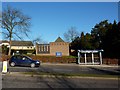
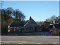
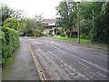
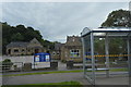
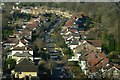
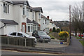
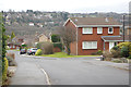
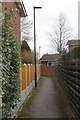
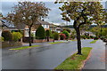
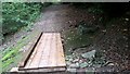
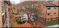
84 photos from this area
Area Information
Key information about the S17 4HP including its size, population, and administrative classification.
- Area Type
- Postcode
- Area Size
- 1.0 hectares
- Population
- 1632
- Population Density
- 3397 people/km²
House Prices in S17 4HP
11
Properties
£310,000
Average Sold Price
£130,000
Lowest Price
£475,000
Highest Price
Showing 11 properties
| Address | Type | Beds | Baths | Last Sale Price | Last Sale Date | |
|---|---|---|---|---|---|---|
| Ford Cottage, Back Lane, Totley, Sheffield, S17 4HP | house | 4 | 2 | £475,000 | Jul 2023 | |
| Woodside, Back Lane, Totley, Sheffield, S17 4HP | house | - | - | £270,000 | Jun 2017 | |
| Glen Rose, Back Lane, Totley, Sheffield, S17 4HP | Cottage | 3 | 1 | £315,000 | Sep 2015 | |
| Riverside, Back Lane, Totley, Sheffield, S17 4HP | Detached | 4 | 4 | £360,000 | Dec 2014 | |
| Glenbourne, Back Lane, Totley, Sheffield, S17 4HP | Terraced | - | - | £130,000 | May 2003 | |
| Rosedale House, 4 Back Lane, Totley, Sheffield, S17 4HP | Detached | - | - | - | - | |
| Brook Cottage, 47 Back Lane, Totley, Sheffield, S17 4HP | house | - | - | - | - | |
| 2, Brookvale Cottages, Back Lane, Totley, Sheffield, S17 4HP | Semi-detached | - | - | - | - | |
| Claybrook Croft, Back Lane, Totley, Sheffield, S17 4HP | Detached | - | - | - | - | |
| 1, Brookvale Cottages, Back Lane, Totley, Sheffield, S17 4HP | Semi-detached | - | - | - | - |
Page 1 of 2
Energy Efficiency in S17 4HP
Amenities
Schools
| Rank | School | Type | Entry gender | Ages |
|---|
Explore more schools in this area
Go to Schools tabDemographics
Household Size
One person
most common
Accommodation Type
Houses
most common
Tenure
70
majority
Ethnic Group
White
most common
Religion
N/A
most common
Household Composition
N/A
most common
Age
47
median
Adults (30-64 years)
most common
Household Deprivation
N/A
with no deprivation
NS-SEC
41
in Lower managerial occupations
Explore more demographic insights in this area
Go to Demographics tabPlanning
Planning Constraints
- Flood RiskPremium
- Ramsar Wetland SitesPremium
- Area of Outstanding Natural BeautyPremium
- Protected Nature ReservePremium
- Protected WoodlandPremium