Area Overview for S17 3DT
Photos of S17 3DT
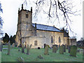
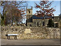

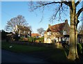
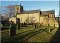
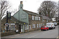
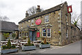

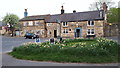
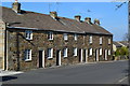
69 photos from this area
Area Information
Key information about the S17 3DT including its size, population, and administrative classification.
- Area Type
- Postcode
- Area Size
- 4526 m²
- Population
- 1733
- Population Density
- 2305 people/km²
House Prices in S17 3DT
17
Properties
£156,357
Average Sold Price
£42,500
Lowest Price
£302,500
Highest Price
Showing 17 properties
| Address | Type | Beds | Baths | Last Sale Price | Last Sale Date | |
|---|---|---|---|---|---|---|
| 16 Causeway Head Road, Sheffield, S17 3DT | Flat | - | - | £100,000 | Jan 2022 | |
| LIMPITS COTTAGE, CAUSEWAY HEAD ROAD, Sheffield, S17 3DT | Detached | 2 | 2 | £302,500 | Oct 2017 | |
| Limpits Cottage, 2 Causeway Head Road, Sheffield, S17 3DT | house | - | - | £302,500 | Oct 2017 | |
| 22 Causeway Head Road, Sheffield, S17 3DT | Flat | 2 | 1 | £105,000 | Apr 2011 | |
| 6 Causeway Head Road, Sheffield, S17 3DT | Flat | - | - | £165,000 | Apr 2006 | |
| 20 Causeway Head Road, Sheffield, S17 3DT | Flat | 1 | - | £77,000 | Jan 2006 | |
| 24 Causeway Head Road, Sheffield, S17 3DT | Flat | 2 | 1 | £42,500 | Nov 1998 | |
| Former 4, Causeway Head Road, Sheffield, S17 3DT | undefined | - | - | - | - | |
| Former 6, Causeway Head Road, Sheffield, S17 3DT | undefined | - | - | - | - | |
| 6A Causeway Head Road, Sheffield, S17 3DT | Flat | - | - | - | - |
Page 1 of 2
Energy Efficiency in S17 3DT
Amenities
Schools
| Rank | School | Type | Entry gender | Ages |
|---|
Explore more schools in this area
Go to Schools tabDemographics
Household Size
Two person
most common
Accommodation Type
Houses
most common
Tenure
81
majority
Ethnic Group
White
most common
Religion
N/A
most common
Household Composition
N/A
most common
Age
47
median
Adults (30-64 years)
most common
Household Deprivation
N/A
with no deprivation
NS-SEC
54
in Lower managerial occupations
Explore more demographic insights in this area
Go to Demographics tabPlanning
Planning Constraints
- Flood RiskPremium
- Ramsar Wetland SitesPremium
- Area of Outstanding Natural BeautyPremium
- Protected Nature ReservePremium
- Protected WoodlandPremium