Area Overview for S13 9BR
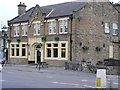
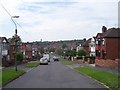
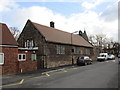
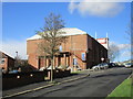
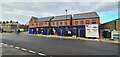
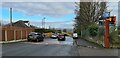
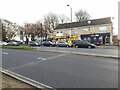
Photos of S13 9BR

Area Information
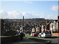
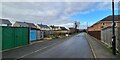
S13 9BR defines a specific residential cluster within Sheffield, England, housing a population of 1,819 residents. This postcode area functions as a compact community unit rather than a sprawling district, offering a contained environment for those seeking a defined neighbourhood within the City. Living in S13 9BR means accepting a quiet, localised existence where daily routines revolve around immediate surroundings rather than distant hubs. The area captures the essence of a traditional English settlement, characterised by its reliance on nearby transport links and commercial zones for broader needs. You will find yourself part of a tightly knit group where the distinction between the immediate street and the wider locality remains clear. The residential nature of the cluster suggests a focus on domestic life, bordered by the practical necessities of shopping and transit just beyond the perimeter. This small population size means you live in a place that feels distinct from the anonymous spread of larger suburbs. The identity of S13 9BR is rooted in its function as a home base for over a thousand households who have chosen this specific location for their daily lives. There is no pretence of grandeur; the area stands as a functional part of Sheffield's urban fabric. For anyone moving here, the adjustment involves integrating into a space that does not change rapidly or expand significantly. The local character is stable, anchored by the permanent residents who view this postcode as their primary home. You are purchasing a piece of Sheffield that retains its identity through sheer scale and local endurance. The area offers a straightforward proposition: a safe, defined pocket of housing within a larger metropolitan framework.
- Area Type
- Postcode
- Area Size
- Not available
- Population
- 1819
- Population Density
- 1938 people/km²
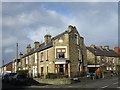
The housing market in S13 9BR is defined by a distinct lack of flats or apartments, with Houses making up the entirety of the accommodation stock. This structural reality means buyers looking for S13 9BR are exclusively accessing standalone properties, likely ranging from terraced houses to larger family homes depending on specific street configurations. With a home ownership rate of 47%, the area presents as a hybrid zone where investment holding and renting coexist, though the dominance of houses suggests a strong preference for permanent residency over short-term tenancies. You will find that the property landscape is not geared towards the high-density demands of a city centre or student quarter. Prospective buyers should note that 47% home ownership indicates a substantial marketing target for local estate agents, yet the remaining 53% implies a vibrant rental sector feeding into existing households. The singular focus on Houses eliminates the segmentation often seen in modern developments where flats and bungalows compete for the same buyers. This uniformity in accommodation type creates a predictable market where property values are driven by house price trends rather than variations in flat sizes. Living in S13 9BR means entering a market where the practicalities of property maintenance, garden stewardship, and local extension rules apply equally to every dwelling. There is no confusion about what you are buying; every address in this postcode offers a house. The density of 1,819 people across these houses ensures that while family life is the norm, it does not come with the cost-per-square-foot inflation often associated with compact city living.
House Prices in S13 9BR
No properties found in this postcode.
Energy Efficiency in S13 9BR
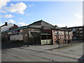
Your daily life in S13 9BR is anchored by a strong commercial presence, with five retail venues in the nearest practical reach. Asda Sheffield, Aldi Handsworth, and Asda Crest are the key supermarkets, meaning you can stock up on groceries without leaving the urban transport network. These three large stores provide convenience for household shopping, reducing the need to travel to distant out-of-town retail parks. The retail category is well-represented, offering a full range of fresh food and household goods directly accessible to residents. Transport infrastructure further enhances your lifestyle, with five nearby metros and five railway stations supporting your mobility needs. You will not be stationary; three major rail stops and three key Metro stations allow you to move elsewhere with ease. The availability of Asda Shefield, Aldi Handsworth, and Asda Crest alongside these transport hubs creates a lifestyle where errands are quick and affordable. You do not need a car for every trip, as the combination of supermarket proximity and public transit covers most daily requirements. Living in S13 9BR means you have the essentials readily to hand, with major retailers like Aldi and Asda forming the backbone of your local supply chain. The area supports an active, mobile lifestyle where shopping and commuting are as easy as they are frequent.
Amenities
Schools
Families considering schools near S13 9BR have three primary local options, though the range is limited due to the small size of the cluster. Athelstan Primary School holds a Good Ofsted rating, providing a secure educational foundation for younger children within walking distance or direct bus reach. The presence of Athelstan Middle School offers a seamless continuation for siblings moving up the system, as it is also part of the Athelstan trust and facilitates familiar environments for students. Athelstan First School rounds out the local primary education options, ensuring that every child in the area has immediate access to state-funded schooling without needing to commute further. This concentration of schools named Athelstan suggests a coordinated approach to local education, potentially offering consistent teaching philosophies and administrative standards. For parents, the proximity of these institutions means that supervision is often more manageable, reducing the need for complex transport logistics in the morning rush. You will not find comprehensive or secondary schools listed for this specific postcode, which implies that students generally transition to other institutions later in their academic careers or rely heavily on the primary/middle school pathway. The existence of these three specific schools confirms that S13 9BR serves as a feeder area for the broader Athelstan educational network. Living in S13 9BR gives you direct access to a recognised primary education cluster without the strain of long travel times to mainstream academies further afield.
| Rank | School | Type | Entry gender | Ages |
|---|
Explore more schools in this area
Go to Schools tabDemographics
The community within S13 9BR reflects a mature demographic profile, with a median age of 47 years. Most commonly, the area is populated by adults aged between 30 and 64 years, indicating a population dominated by established households rather than young singles or families with very young children. You will not find a youthful buzz typical of student enclaves or retirement zones; instead, the streets host a generation in their peak earning and parenting years. Home ownership stands at 47%, a figure that suggests a balanced mix of owner-occupiers and tenants, though the high prevalence of Houses points towards a stock suitable for families or groups. Predominant ethnicity within S13 9BR is White, which aligns with the broader demographic trends of many older Sheffield suburbs. The accommodation type is exclusively Houses, meaning you will not encounter the density of flats or apartments seen in other urban districts. This housing style supports a lower-density lifestyle where gardens and private outdoor space are likely fixtures of the neighbourhood. With almost half of the residents owning their homes, there is a significant stake in the stability and upkeep of the local environment. The age distribution implies that families have likely been living here for considerable periods, creating a sense of settled continuity. You are buying into a neighbourhood where the current generation has shaped the community's rhythm over decades.
Household Size
Accommodation Type
Tenure
Ethnic Group
Religion
Household Composition
Age
Household Deprivation
NS-SEC
Explore more demographic insights in this area
Go to Demographics tabPlanning
Planning Constraints
- Flood RiskPremium
- Ramsar Wetland SitesPremium
- Area of Outstanding Natural BeautyPremium
- Protected Nature ReservePremium
- Protected WoodlandPremium