Area Overview for S13 7YR
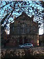
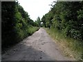
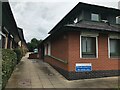
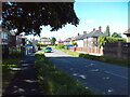
Photos of S13 7YR


Area Information
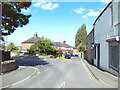
S13 7YR is a specific postcode cluster in Sheffield reflecting a compact residential environment with a total population of 1,445 residents. This small community functions as a concentrated neighbourhood where daily life revolves around immediate local access. You can expect a setting defined by tight-knit streets rather than sprawling developments, offering a sense of place without the anonymity of larger urban zones. The area sits within South Yorkshire, providing a foothold in a city with broader connectivity options while maintaining a distinct local identity. Residents here navigate a landscape where nearby stations and local shops form the backbone of routine commutes and errands. Living in S13 7YR means engaging with a space designed for efficiency rather than grandeur. The population density suggests a community where neighbours are likely to know one another, fostering interactions that define the social fabric of the postcode. This residential cluster does not offer expansive green spaces or massive commercial districts within its immediate bounds, but it provides practical access to established services. The small scale of 1,445 inhabitants ensures that you are part of a defined group rather than lost in a crowd of thousands. Your day-to-day experience will be shaped by the proximity to essential amenities and the clear residential nature of the streets surrounding this specific address.
- Area Type
- Postcode
- Area Size
- Not available
- Population
- 1445
- Population Density
- 2141 people/km²
The property market in S13 7YR is characterised by a distinct lack ofOwner-occupiers compared to the rental sector. With only 20% of residents owning their homes, the vast majority of properties are let to tenants. Flats constitute the primary accommodation type within this residential cluster, suggesting a building stock oriented towards higher density living rather than detached or semi-detached houses. This market structure typically attracts professionals seeking city centre proximity or individuals looking for hassle-free living without the responsibility of maintenance. Purchasing a home here is rare, as most transactions involve renting existing flats rather than acquiring freehold properties. The high rental penetration indicates that demand in S13 7YR often exceeds the supply of traditional ownership opportunities. If you are considering buying, you may find limited options within the immediate postcode boundaries themselves. However, the presence of a small population cluster means that the housing stock is finite. You should expect a market where landlords dominate the listings, offering various flats to prospective renters seeking convenience.
House Prices in S13 7YR
No properties found in this postcode.
Energy Efficiency in S13 7YR
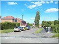
Your daily life in S13 7YR is supported by a range of retail and transport amenities within practical reach. Local shopping options include Co-op Chapel, Spar, and another Spar location, providing essentials and convenience within walking distance. For those who need to move further afield, you have access to five railway stations and five metro stops nearby. Woodhouse Railway Station, Darnall Railway Station, and Sheffield Railway Station offer connections to wider parts of the region. Metro access at Hackenthorpe, Donetsk Way, and Moss Way complements rail options for shorter local trips. This amenity mix means you do not need to drive for routine grocery shopping or short commutes. The five retail outlets and extensive public transport hubs create a network that reduces the need for a car. You can manage your week with a combination of local shops for daily items and main stations for weekend travel or business meetings. Living in S13 7YR offers a lifestyle where convenience is built into the infrastructure around you.
Amenities
Schools
Families in S13 7YR have access to Shirebrook Primary School, which serves the local primary education needs. This school is the only institution directly listed within the immediate school catchment for this postcode. The primary focus for parents here centres on this single educational facility, as no other schools are provided in the immediate vicinity. Attending Shirebrook Primary School means your child will be educated within a designated zone that caters to the local population of 1,445 residents. While no secondary schools are listed in the immediate proximity, the presence of Shirebrook Primary School indicates a foundational education focus in the area. You will need to consider transport options like the nearby Woodhouse or Sheffield Railway Stations if you are looking for post-primary education elsewhere. The single school offering creates a straightforward choice for families, removing the complexity of navigating multiple educational providers within the local neighbourhood. Living in S13 7YR entails relying heavily on this key institution for early childhood and primary stage education.
| Rank | School | Type | Entry gender | Ages |
|---|
Explore more schools in this area
Go to Schools tabDemographics
The community in S13 7YR is defined by an older demographic profile with a median age of 47 years. Most residents fall into the adult age range of 30 to 64 years, creating a neighbourhood dominated by established adults rather than young families or empty nesters. This age distribution suggests a population that has settled long-term rather than those in transient generations. With only 20% home ownership rates, the area presents a predominantly rental landscape where tenants outnumber owners significantly. You will encounter flats as the predominant accommodation type, reflecting the housing stock's design for density and proximity to services. The predominant ethnic group in S13 7YR is White, which aligns with the wider demographic trends of the district. These figures indicate a community where stability is common due to the concentration of adult residents. The low ownership rate of 20% versus the high prevalence of rental flats shapes the social dynamic, often seen in areas with enhanced security measures or specific planning histories. For you, this means interacting primarily with working-age adults who view this postcode as their primary base.
Household Size
Accommodation Type
Tenure
Ethnic Group
Religion
Household Composition
Age
Household Deprivation
NS-SEC
Explore more demographic insights in this area
Go to Demographics tabPlanning
Planning Constraints
- Flood RiskPremium
- Ramsar Wetland SitesPremium
- Area of Outstanding Natural BeautyPremium
- Protected Nature ReservePremium
- Protected WoodlandPremium