Area Overview for S12 3HS
Photos of S12 3HS
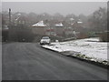
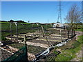
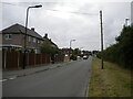
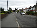
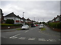
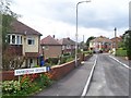
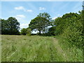
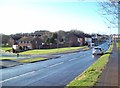
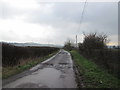
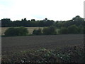
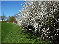
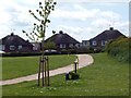
14 photos from this area
Area Information
Key information about the S12 3HS including its size, population, and administrative classification.
- Area Type
- Postcode
- Area Size
- 7.4 hectares
- Population
- 1583
- Population Density
- 2825 people/km²
House Prices in S12 3HS
29
Properties
£104,085
Average Sold Price
£26,000
Lowest Price
£229,000
Highest Price
Showing 29 properties
| Address | Type | Beds | Baths | Last Sale Price | Last Sale Date | |
|---|---|---|---|---|---|---|
| 3 Carter Hall Road, Sheffield, S12 3HS | house | - | - | £161,500 | Dec 2025 | |
| 19 Carter Hall Road, Sheffield, S12 3HS | Semi-detached | 3 | 1 | £229,000 | Apr 2025 | |
| 9 Carter Hall Road, Sheffield, S12 3HS | Terraced | 2 | 1 | £181,500 | Apr 2023 | |
| 16 Carter Hall Road, Sheffield, S12 3HS | Detached | 3 | 1 | £163,000 | Jan 2020 | |
| 11 Carter Hall Road, Sheffield, S12 3HS | Terraced | 3 | 1 | £147,500 | Dec 2019 | |
| 30 Carter Hall Road, Sheffield, S12 3HS | Semi-detached | 2 | 1 | £145,000 | Nov 2019 | |
| 18 Carter Hall Road, Sheffield, S12 3HS | Semi-detached | 2 | 1 | £105,000 | Feb 2019 | |
| 26 Carter Hall Road, Sheffield, S12 3HS | Semi-detached | 3 | - | £165,000 | Nov 2016 | |
| 22 Carter Hall Road, Sheffield, S12 3HS | Semi-detached | 2 | 1 | £130,000 | Sep 2016 | |
| 24 Carter Hall Road, Sheffield, S12 3HS | Semi-detached | 3 | - | £135,000 | Sep 2015 |
Page 1 of 3
Energy Efficiency in S12 3HS
Amenities
Schools
| Rank | School | Type | Entry gender | Ages |
|---|
Explore more schools in this area
Go to Schools tabDemographics
Household Size
Two person
most common
Accommodation Type
Houses
most common
Tenure
81
majority
Ethnic Group
White
most common
Religion
N/A
most common
Household Composition
N/A
most common
Age
47
median
Adults (30-64 years)
most common
Household Deprivation
N/A
with no deprivation
NS-SEC
32
in Lower managerial occupations
Explore more demographic insights in this area
Go to Demographics tabPlanning
Planning Constraints
- Flood RiskPremium
- Ramsar Wetland SitesPremium
- Area of Outstanding Natural BeautyPremium
- Protected Nature ReservePremium
- Protected WoodlandPremium