Area Overview for S12 2AF
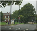
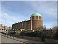
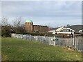
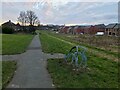
Photos of S12 2AF


Area Information
S12 2AF is a specific postcode area covering a small residential cluster in England. It occupies a land size of 5,835 square metres and holds a population of 1,430 residents. This high density means the residential cluster is tightly packed within its boundaries. Living in S12 2AF involves daily life centred around a defined group of people rather than sprawling suburbs. The area functions as a compact neighbourhood where proximity plays a major role in routine activities. Its identity is anchored by the postcode itself, marking a distinct zone within the wider Sheffield region. You walk between neighbours frequently because the physical space is limited. This small footprint creates an environment where community interactions happen naturally due to close quarters. The area is characterised by its concentration of homes rather than open green space. It serves as a functional living space for those seeking to be close to the heart of the action. The specific nature of this cluster defines the daily rhythm for everyone residing here.
- Area Type
- Postcode
- Area Size
- 5835 m²
- Population
- 1430
- Population Density
- 4650 people/km²
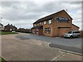
The housing market in S12 2AF is driven by a stock dominated by houses rather than flats or apartments. With 66% of the population being homeowners, the area functions as a market for those seeking to buy and hold property rather than rent short-term. This high ownership rate suggests you are looking at homes in S12 2AF as long-term investments or family bases. The accommodation type classification reinforces that this is a residential zone built for house living rather than high-density flat living. Buyers here typically engage with sellers who have lived in the area for years, given the prevalence of owner-occupiers. The market reflects a desire for standalone housing structures over shared building options. This makes S12 2AF particularly suitable for those seeking the traditional benefits of house ownership. The 66% figure indicates a strong economy of established owners. If you are considering moving, expect a market where sellers value the area enough to keep their homes rather than selling repeatedly. The property landscape is consistent with the needs of the 30-to-64-year-old demographic found here.
House Prices in S12 2AF
Showing 1 properties
| Address | Type | Beds | Baths | Last Sale Price | Last Sale Date | |
|---|---|---|---|---|---|---|
| 17 Queen Mary Close, Sheffield, S12 2AF | undefined | - | - | - | - |
Energy Efficiency in S12 2AF
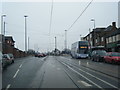
Daily life in S12 2AF offers convenient access to a range of practical amenities within walking or short driving distance. Your shopping needs are met by five retail options including Asda Sheffield, Co-op Northern, and Morrisons Daily. These supermarkets provide essential groceries and household goods without requiring long journeys. For public transport, you are close to five metro locations such as Manor Top, Hollinsend, and Spring Lane. Rail travel is accessible via five nearby stations including Darnall Railway Station, Sheffield Railway Station, and Woodhouse Railway Station. This network allows you to commute to central Sheffield or other destinations easily. The blend of major supermarkets and transport hubs creates a self-sufficient lifestyle for residents. You can run errands at Asda Sheffield or catch a train at Darnall from a common base. The presence of these specific venues means you do not rely on the internet for all needs. Shopping trips and commutes integrate seamlessly into your weekly routine. Living in S12 2AF places you in a position to access everything you need efficiently.
Amenities
Schools
Families living in S12 2AF have access to specific educational institutions within practical reach. Intake Primary School is the notable nearby school located in this vicinity. It is a primary school operating under an Ofsted rating of good. This single named facility provides primary education for children in the local catchment area. The presence of a school with a good rating offers a tangible basis for families choosing homes near S12 2AF. While data does not list secondary schools, the primary option ensures early education is covered nearby. The availability of Intake Primary School means you do not need to commute far to start your child's education. A good Ofsted rating suggests the school meets regulatory standards for teaching and environment. This school serves the residential cluster directly, integrating education into the daily structure of life in the area. Parents in S12 2AF rely on this institution for their children's academic development. The school's status as a good provider adds a layer of confidence for prospective buyers.
| Rank | School | Type | Entry gender | Ages |
|---|
Explore more schools in this area
Go to Schools tabDemographics
The community in S12 2AF displays a clear demographic profile with a median age of 47. The most common age range is adults between 30 and 64 years. This indicates a population made up primarily of established residents rather than young professionals or retirees. Home ownership stands at 66%, meaning two-thirds of households own their property outright or with a mortgage. Accommodation types consist overwhelmingly of houses. The predominant ethnic group is White. These figures suggest a stable, long-term community focused on family life. The high home ownership rate points to residents who have settled permanently in the area. Most households fall into the middle-to-senior age bracket, which influences local spending and service usage. With 66% of people owning their homes, the area likely feels more static and rooted than飞快 rental markets. The demographic mix supports a neighbourhood that values stability and traditional housing forms. You will find families and established couples forming the bulk of the population structure.
Household Size
Accommodation Type
Tenure
Ethnic Group
Religion
Household Composition
Age
Household Deprivation
NS-SEC
Explore more demographic insights in this area
Go to Demographics tabPlanning
Planning Constraints
- Flood RiskPremium
- Ramsar Wetland SitesPremium
- Area of Outstanding Natural BeautyPremium
- Protected Nature ReservePremium
- Protected WoodlandPremium