Area Overview for S11 9NH
Photos of S11 9NH
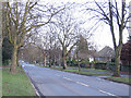
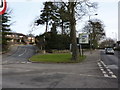
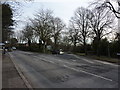
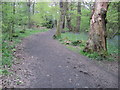
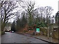
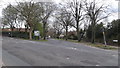
89 photos from this area
Area Information
Key information about the S11 9NH including its size, population, and administrative classification.
- Area Type
- Postcode
- Area Size
- 2.5 hectares
- Population
- 1671
- Population Density
- 907 people/km²
House Prices in S11 9NH
10
Properties
£893,750
Average Sold Price
£385,000
Lowest Price
£1,550,000
Highest Price
Showing 10 properties
| Address | Type | Beds | Baths | Last Sale Price | Last Sale Date | |
|---|---|---|---|---|---|---|
| 483 Whirlowdale Road, Sheffield, S11 9NH | Detached | 5 | 3 | £1,550,000 | Jun 2024 | |
| 473 Whirlowdale Road, Sheffield, S11 9NH | house | - | - | £1,500,000 | Mar 2022 | |
| 469 Whirlowdale Road, Sheffield, S11 9NH | house | - | - | £865,000 | Mar 2013 | |
| 471 Whirlowdale Road, Sheffield, S11 9NH | house | - | - | £830,000 | Jul 2011 | |
| 465 Whirlowdale Road, Sheffield, S11 9NH | house | - | - | £880,000 | Jul 2011 | |
| 479 Whirlowdale Road, Sheffield, S11 9NH | Detached | 6 | 4 | £675,000 | Jun 2002 | |
| 475 Whirlowdale Road, Sheffield, S11 9NH | Detached | - | - | £465,000 | Oct 2000 | |
| 477 Whirlowdale Road, Sheffield, S11 9NH | Detached | - | - | £385,000 | Jun 1998 | |
| 467 Whirlowdale Road, Sheffield, S11 9NH | Detached | - | - | - | - | |
| 481 Whirlowdale Road, Sheffield, S11 9NH | Detached | - | - | - | - |
Energy Efficiency in S11 9NH
Amenities
Schools
| Rank | School | Type | Entry gender | Ages |
|---|
Explore more schools in this area
Go to Schools tabDemographics
Household Size
Two person
most common
Accommodation Type
Houses
most common
Tenure
93
majority
Ethnic Group
White
most common
Religion
N/A
most common
Household Composition
N/A
most common
Age
47
median
Adults (30-64 years)
most common
Household Deprivation
N/A
with no deprivation
NS-SEC
59
in Lower managerial occupations
Explore more demographic insights in this area
Go to Demographics tabPlanning
Planning Constraints
- Flood RiskPremium
- Ramsar Wetland SitesPremium
- Area of Outstanding Natural BeautyPremium
- Protected Nature ReservePremium
- Protected WoodlandPremium