Area Overview for S11 9FR
Photos of S11 9FR
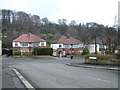

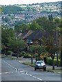
61 photos from this area
Area Information
Key information about the S11 9FR including its size, population, and administrative classification.
- Area Type
- Postcode
- Area Size
- 1.5 hectares
- Population
- 1655
- Population Density
- 4350 people/km²
House Prices in S11 9FR
26
Properties
£277,700
Average Sold Price
£210,000
Lowest Price
£367,000
Highest Price
Showing 26 properties
| Address | Type | Beds | Baths | Last Sale Price | Last Sale Date | |
|---|---|---|---|---|---|---|
| 49 Charnley Avenue, Sheffield, S11 9FR | Detached | 3 | 1 | £296,000 | Jun 2024 | |
| 63 Charnley Avenue, Sheffield, S11 9FR | Semi-detached | 3 | 2 | £367,000 | Jan 2024 | |
| 53 Charnley Avenue, Sheffield, S11 9FR | house | - | - | £320,000 | Dec 2021 | |
| 89 Charnley Avenue, Sheffield, S11 9FR | house | - | - | £350,000 | Jan 2021 | |
| 81 Charnley Avenue, Sheffield, S11 9FR | house | - | - | £280,000 | Dec 2020 | |
| 55 Charnley Avenue, Sheffield, S11 9FR | Semi-detached | 3 | 1 | £305,250 | Jul 2019 | |
| 83 Charnley Avenue, Sheffield, S11 9FR | house | - | - | £360,000 | Feb 2019 | |
| 67 Charnley Avenue, Sheffield, S11 9FR | house | - | - | £225,000 | Dec 2018 | |
| 65 Charnley Avenue, Sheffield, S11 9FR | Semi-detached | 3 | - | £220,000 | Oct 2017 | |
| 41 Charnley Avenue, Sheffield, S11 9FR | Semi-detached | 3 | 1 | £285,000 | Aug 2017 |
Page 1 of 3
Energy Efficiency in S11 9FR
Amenities
Schools
| Rank | School | Type | Entry gender | Ages |
|---|
Explore more schools in this area
Go to Schools tabDemographics
Household Size
Family (3-5 people)
most common
Accommodation Type
Houses
most common
Tenure
93
majority
Ethnic Group
White
most common
Religion
N/A
most common
Household Composition
N/A
most common
Age
47
median
Adults (30-64 years)
most common
Household Deprivation
N/A
with no deprivation
NS-SEC
50
in Lower managerial occupations
Explore more demographic insights in this area
Go to Demographics tabPlanning
Planning Constraints
- Flood RiskPremium
- Ramsar Wetland SitesPremium
- Area of Outstanding Natural BeautyPremium
- Protected Nature ReservePremium
- Protected WoodlandPremium