Area Overview for S11 9BW
Photos of S11 9BW
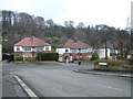

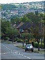
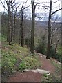
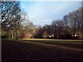
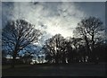
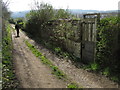
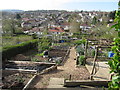
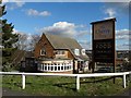
61 photos from this area
Area Information
Key information about the S11 9BW including its size, population, and administrative classification.
- Area Type
- Postcode
- Area Size
- 1.2 hectares
- Population
- 1344
- Population Density
- 6208 people/km²
House Prices in S11 9BW
60
Properties
£343,733
Average Sold Price
£115,000
Lowest Price
£695,000
Highest Price
Showing 60 properties
| Address | Type | Beds | Baths | Last Sale Price | Last Sale Date | |
|---|---|---|---|---|---|---|
| 74 Brincliffe Edge Road, Sheffield, S11 9BW | Terraced | 3 | 1 | £325,000 | Sep 2025 | |
| 18 Brincliffe Edge Road, Sheffield, S11 9BW | Semi-detached | 3 | 2 | £417,000 | Dec 2023 | |
| 72 Brincliffe Edge Road, Sheffield, S11 9BW | house | - | - | £415,000 | May 2023 | |
| 64 Brincliffe Edge Road, Sheffield, S11 9BW | house | - | - | £695,000 | Sep 2022 | |
| 76 Brincliffe Edge Road, Sheffield, S11 9BW | house | - | - | £280,000 | Dec 2020 | |
| 60 Brincliffe Edge Road, Sheffield, S11 9BW | Semi-detached | 4 | 2 | £440,000 | Jun 2019 | |
| 68 Brincliffe Edge Road, Sheffield, S11 9BW | Semi-detached | 4 | 3 | £542,500 | Mar 2019 | |
| 16 Brincliffe Edge Road, Sheffield, S11 9BW | Semi-detached | 4 | 1 | £296,000 | Nov 2018 | |
| 58 Brincliffe Edge Road, Sheffield, S11 9BW | Detached | 4 | 3 | £660,000 | Jul 2017 | |
| 80 Brincliffe Edge Road, Sheffield, S11 9BW | Cottage | 3 | - | £295,000 | Dec 2013 |
Page 1 of 6
Energy Efficiency in S11 9BW
Amenities
Schools
| Rank | School | Type | Entry gender | Ages |
|---|
Explore more schools in this area
Go to Schools tabDemographics
Household Size
Family (3-5 people)
most common
Accommodation Type
Houses
most common
Tenure
73
majority
Ethnic Group
White
most common
Religion
N/A
most common
Household Composition
N/A
most common
Age
47
median
Adults (30-64 years)
most common
Household Deprivation
N/A
with no deprivation
NS-SEC
47
in Lower managerial occupations
Explore more demographic insights in this area
Go to Demographics tabPlanning
Planning Constraints
- Flood RiskPremium
- Ramsar Wetland SitesPremium
- Area of Outstanding Natural BeautyPremium
- Protected Nature ReservePremium
- Protected WoodlandPremium