Area Overview for S11 7LH
Photos of S11 7LH

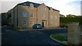
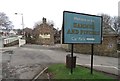
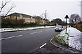
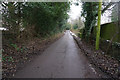
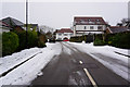
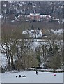
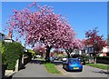
36 photos from this area
Area Information
Key information about the S11 7LH including its size, population, and administrative classification.
- Area Type
- Postcode
- Area Size
- 10.9 hectares
- Population
- 1521
- Population Density
- 4222 people/km²
House Prices in S11 7LH
12
Properties
£354,575
Average Sold Price
£75,000
Lowest Price
£499,950
Highest Price
Showing 12 properties
| Address | Type | Beds | Baths | Last Sale Price | Last Sale Date | |
|---|---|---|---|---|---|---|
| 173 High Storrs Road, Sheffield, S11 7LH | Detached | 2 | 1 | £430,000 | Sep 2025 | |
| 167 High Storrs Road, Sheffield, S11 7LH | Bungalow | 2 | 1 | £370,000 | Oct 2023 | |
| 185 High Storrs Road, Sheffield, S11 7LH | house | - | - | £340,000 | Jul 2018 | |
| 183 High Storrs Road, Sheffield, S11 7LH | Detached | 5 | 2 | £412,500 | Jun 2009 | |
| 175 High Storrs Road, Sheffield, S11 7LH | house | - | - | £499,950 | Sep 2007 | |
| 165 High Storrs Road, Sheffield, S11 7LH | Bungalow | - | - | £75,000 | Apr 1996 | |
| 177 High Storrs Road, Sheffield, S11 7LH | Detached | 5 | 2 | - | - | |
| 171 High Storrs Road, Sheffield, S11 7LH | Bungalow | - | - | - | - | |
| 169 High Storrs Road, Sheffield, S11 7LH | Detached | - | - | - | - | |
| 181 High Storrs Road, Sheffield, S11 7LH | Detached | - | - | - | - |
Page 1 of 2
Energy Efficiency in S11 7LH
Amenities
Schools
| Rank | School | Type | Entry gender | Ages |
|---|
Explore more schools in this area
Go to Schools tabDemographics
Household Size
Family (3-5 people)
most common
Accommodation Type
Houses
most common
Tenure
96
majority
Ethnic Group
White
most common
Religion
N/A
most common
Household Composition
N/A
most common
Age
47
median
Adults (30-64 years)
most common
Household Deprivation
N/A
with no deprivation
NS-SEC
58
in Lower managerial occupations
Explore more demographic insights in this area
Go to Demographics tabPlanning
Planning Constraints
- Flood RiskPremium
- Ramsar Wetland SitesPremium
- Area of Outstanding Natural BeautyPremium
- Protected Nature ReservePremium
- Protected WoodlandPremium