Area Overview for S11 7JX
Photos of S11 7JX


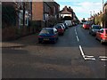
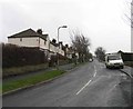
100 photos from this area
Area Information
Key information about the S11 7JX including its size, population, and administrative classification.
- Area Type
- Postcode
- Area Size
- 1.3 hectares
- Population
- 1490
- Population Density
- 3505 people/km²
House Prices in S11 7JX
34
Properties
£240,526
Average Sold Price
£57,750
Lowest Price
£461,250
Highest Price
Showing 34 properties
| Address | Type | Beds | Baths | Last Sale Price | Last Sale Date | |
|---|---|---|---|---|---|---|
| 21 High Storrs Crescent, Sheffield, S11 7JX | Semi-detached | 4 | 2 | £461,250 | Mar 2025 | |
| 49 High Storrs Crescent, Sheffield, S11 7JX | Semi-detached | 3 | 1 | £380,000 | Sep 2020 | |
| 5 High Storrs Crescent, Sheffield, S11 7JX | Semi-detached | 3 | 2 | £325,000 | Mar 2019 | |
| 31 High Storrs Crescent, Sheffield, S11 7JX | Semi-detached | 3 | - | £250,000 | Mar 2018 | |
| 17 High Storrs Crescent, Sheffield, S11 7JX | Semi-detached | 3 | 2 | £337,000 | Oct 2017 | |
| 51 High Storrs Crescent, Sheffield, S11 7JX | house | - | - | £228,500 | Jul 2015 | |
| 65 High Storrs Crescent, Sheffield, S11 7JX | Semi-detached | 3 | - | £200,000 | Dec 2013 | |
| 25 High Storrs Crescent, Sheffield, S11 7JX | house | - | - | £250,000 | Aug 2013 | |
| 37 High Storrs Crescent, Sheffield, S11 7JX | Semi-detached | - | - | £265,000 | Jun 2012 | |
| 47 High Storrs Crescent, Sheffield, S11 7JX | house | - | - | £207,500 | Jul 2010 |
Page 1 of 4
Energy Efficiency in S11 7JX
Amenities
Schools
| Rank | School | Type | Entry gender | Ages |
|---|
Explore more schools in this area
Go to Schools tabDemographics
Household Size
Family (3-5 people)
most common
Accommodation Type
Houses
most common
Tenure
83
majority
Ethnic Group
White
most common
Religion
N/A
most common
Household Composition
N/A
most common
Age
47
median
Adults (30-64 years)
most common
Household Deprivation
N/A
with no deprivation
NS-SEC
57
in Lower managerial occupations
Explore more demographic insights in this area
Go to Demographics tabPlanning
Planning Constraints
- Flood RiskPremium
- Ramsar Wetland SitesPremium
- Area of Outstanding Natural BeautyPremium
- Protected Nature ReservePremium
- Protected WoodlandPremium