Area Overview for S10 5DS
Photos of S10 5DS

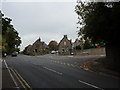


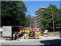
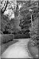
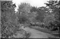


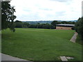
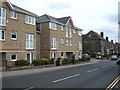
71 photos from this area
Area Information
Key information about the S10 5DS including its size, population, and administrative classification.
- Area Type
- Postcode
- Area Size
- 6222 m²
- Population
- 1617
- Population Density
- 5666 people/km²
House Prices in S10 5DS
10
Properties
£300,383
Average Sold Price
£61,500
Lowest Price
£540,000
Highest Price
Showing 10 properties
| Address | Type | Beds | Baths | Last Sale Price | Last Sale Date | |
|---|---|---|---|---|---|---|
| 395 Manchester Road, Crosspool, Sheffield, S10 5DS | house | - | - | £540,000 | Jul 2025 | |
| 467 Manchester Road, Crosspool, Sheffield, S10 5DS | Terraced | 3 | 1 | £441,000 | Nov 2024 | |
| 469 Manchester Road, Crosspool, Sheffield, S10 5DS | Terraced | 4 | - | £375,000 | Jan 2022 | |
| 463 Manchester Road, Crosspool, Sheffield, S10 5DS | Terraced | 4 | - | £275,000 | Apr 2017 | |
| 475 Manchester Road, Crosspool, Sheffield, S10 5DS | house | - | - | £320,000 | Oct 2016 | |
| 473 Manchester Road, Crosspool, Sheffield, S10 5DS | Terraced | 5 | - | £235,000 | Mar 2011 | |
| 465 Manchester Road, Crosspool, Sheffield, S10 5DS | Terraced | - | - | £234,950 | Jul 2007 | |
| 461 Manchester Road, Crosspool, Sheffield, S10 5DS | house | - | - | £221,000 | Apr 2007 | |
| 471 Manchester Road, Crosspool, Sheffield, S10 5DS | house | - | - | £61,500 | Feb 1997 | |
| 393 Manchester Road, Crosspool, Sheffield, S10 5DS | Semi-detached | - | - | - | - |
Energy Efficiency in S10 5DS
Amenities
Schools
| Rank | School | Type | Entry gender | Ages |
|---|
Explore more schools in this area
Go to Schools tabDemographics
Household Size
Two person
most common
Accommodation Type
Houses
most common
Tenure
72
majority
Ethnic Group
White
most common
Religion
N/A
most common
Household Composition
N/A
most common
Age
47
median
Adults (30-64 years)
most common
Household Deprivation
N/A
with no deprivation
NS-SEC
47
in Lower managerial occupations
Explore more demographic insights in this area
Go to Demographics tabPlanning
Planning Constraints
- Flood RiskPremium
- Ramsar Wetland SitesPremium
- Area of Outstanding Natural BeautyPremium
- Protected Nature ReservePremium
- Protected WoodlandPremium