Area Overview for S10 4QZ
Photos of S10 4QZ
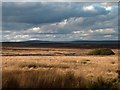
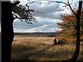
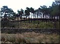
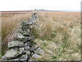
12 photos from this area
Area Information
Key information about the S10 4QZ including its size, population, and administrative classification.
- Area Type
- Postcode
- Area Size
- 19.0 km²
- Population
- 2116
- Population Density
- 71 people/km²
House Prices in S10 4QZ
10
Properties
£508,333
Average Sold Price
£100,000
Lowest Price
£1,200,000
Highest Price
Showing 10 properties
| Address | Type | Beds | Baths | Last Sale Price | Last Sale Date | |
|---|---|---|---|---|---|---|
| Stanedge Lodge, Long Causeway, Sheffield, S10 4QZ | Retail | 8 | 6 | £1,200,000 | Dec 2023 | |
| 1, Filter Station Cottages, Long Causeway, Sheffield, S10 4QZ | Detached | 3 | - | £310,000 | Dec 2019 | |
| Stable House, Long Causeway, Sheffield, S10 4QZ | house | - | - | £542,500 | Mar 2019 | |
| Fairthorn Lodge, Long Causeway, Sheffield, S10 4QZ | Detached | 6 | 3 | £787,500 | May 2018 | |
| 3, Filter Station Cottages, Long Causeway, Sheffield, S10 4QZ | house | 3 | 1 | £100,000 | May 2008 | |
| 2, Filter Station Cottages, Long Causeway, Sheffield, S10 4QZ | Semi-detached | - | - | £110,000 | May 2008 | |
| 2, Reservoir Cottages, Redmires Road, Sheffield, S10 4QZ | Detached | 4 | 3 | - | - | |
| Stables, Wyming Brook Farm, Long Causeway, Sheffield, S10 4QZ | Equestrian | - | - | - | - | |
| Former Redmires Water Treatment Works, Long Causeway, Sheffield, S10 4QZ | Industrial | - | - | - | - | |
| Bird Observation Hide, Long Causeway, Sheffield, S10 4QZ | Leisure | - | - | - | - |
Energy Efficiency in S10 4QZ
Amenities
Schools
| Rank | School | Type | Entry gender | Ages |
|---|
Explore more schools in this area
Go to Schools tabDemographics
Household Size
Two person
most common
Accommodation Type
Houses
most common
Tenure
88
majority
Ethnic Group
White
most common
Religion
N/A
most common
Household Composition
N/A
most common
Age
47
median
Adults (30-64 years)
most common
Household Deprivation
N/A
with no deprivation
NS-SEC
57
in Lower managerial occupations
Explore more demographic insights in this area
Go to Demographics tabPlanning
Planning Constraints
- Flood RiskPremium
- Ramsar Wetland SitesPremium
- Area of Outstanding Natural BeautyPremium
- Protected Nature ReservePremium