Area Overview for S10 4LG
Photos of S10 4LG
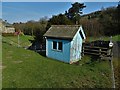
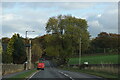
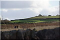
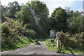
40 photos from this area
Area Information
Key information about the S10 4LG including its size, population, and administrative classification.
- Area Type
- Postcode
- Area Size
- 21.2 hectares
- Population
- 2116
- Population Density
- 71 people/km²
House Prices in S10 4LG
35
Properties
£452,089
Average Sold Price
£80,000
Lowest Price
£1,175,000
Highest Price
Showing 35 properties
| Address | Type | Beds | Baths | Last Sale Price | Last Sale Date | |
|---|---|---|---|---|---|---|
| 448 Redmires Road, Sheffield, S10 4LG | Detached | 4 | 2 | £950,000 | Dec 2023 | |
| 480 Redmires Road, Sheffield, S10 4LG | Detached | 5 | 1 | £610,000 | Jun 2023 | |
| 442 Redmires Road, Sheffield, S10 4LG | house | 5 | 3 | £1,175,000 | Oct 2020 | |
| 410 Redmires Road, Sheffield, S10 4LG | Detached | 3 | 2 | £433,000 | Oct 2019 | |
| 452 Redmires Road, Sheffield, S10 4LG | Bungalow | 3 | 1 | £750,000 | Aug 2019 | |
| 438 Redmires Road, Sheffield, S10 4LG | Bungalow | - | - | £475,000 | Aug 2017 | |
| 420 Redmires Road, Sheffield, S10 4LG | Detached | 4 | 2 | £401,500 | Apr 2016 | |
| 416 Redmires Road, Sheffield, S10 4LG | Detached | 4 | - | £410,000 | Aug 2015 | |
| 458 Redmires Road, Sheffield, S10 4LG | Bungalow | 4 | 2 | £435,000 | Apr 2015 | |
| 444 Redmires Road, Sheffield, S10 4LG | Bungalow | - | - | £300,000 | Mar 2011 |
Page 1 of 4
Energy Efficiency in S10 4LG
Amenities
Schools
| Rank | School | Type | Entry gender | Ages |
|---|
Explore more schools in this area
Go to Schools tabDemographics
Household Size
Two person
most common
Accommodation Type
Houses
most common
Tenure
88
majority
Ethnic Group
White
most common
Religion
N/A
most common
Household Composition
N/A
most common
Age
47
median
Adults (30-64 years)
most common
Household Deprivation
N/A
with no deprivation
NS-SEC
57
in Lower managerial occupations
Explore more demographic insights in this area
Go to Demographics tabPlanning
Planning Constraints
- Flood RiskPremium
- Ramsar Wetland SitesPremium
- Area of Outstanding Natural BeautyPremium
- Protected Nature ReservePremium
- Protected WoodlandPremium