Area Overview for S10 3TE
Photos of S10 3TE
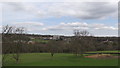
96 photos from this area
Area Information
Key information about the S10 3TE including its size, population, and administrative classification.
- Area Type
- Postcode
- Area Size
- 18.9 hectares
- Population
- 1609
- Population Density
- 523 people/km²
House Prices in S10 3TE
52
Properties
£503,415
Average Sold Price
£67,100
Lowest Price
£3,250,000
Highest Price
Showing 52 properties
| Address | Type | Beds | Baths | Last Sale Price | Last Sale Date | |
|---|---|---|---|---|---|---|
| Brook Lodge, 189 Brookhouse Hill, Sheffield, S10 3TE | Detached | 5 | 3 | £3,250,000 | Apr 2023 | |
| 137 Brookhouse Hill, Sheffield, S10 3TE | house | - | - | £901,600 | Jun 2021 | |
| 83 Brookhouse Hill, Sheffield, S10 3TE | Semi-detached | 3 | 1 | £647,360 | Mar 2021 | |
| 113 Brookhouse Hill, Sheffield, S10 3TE | house | - | - | £310,000 | Jan 2021 | |
| 94 Brookhouse Hill, Sheffield, S10 3TE | house | - | - | £356,100 | Nov 2020 | |
| 123 Brookhouse Hill, Sheffield, S10 3TE | Detached | 4 | 1 | £652,500 | Aug 2018 | |
| 3, Beech Dene Cottages, Brookhouse Hill, Sheffield, S10 3TE | Detached | 4 | 3 | £230,000 | Oct 2017 | |
| 119 Brookhouse Hill, Sheffield, S10 3TE | house | 4 | - | £304,500 | Sep 2017 | |
| 2, Beech Dene Cottages, Brookhouse Hill, Sheffield, S10 3TE | Cottage | 2 | 1 | £215,000 | Oct 2016 | |
| 102 Brookhouse Hill, Sheffield, S10 3TE | Semi-detached | 5 | - | £389,950 | Sep 2016 |
Page 1 of 6
Energy Efficiency in S10 3TE
Amenities
Schools
| Rank | School | Type | Entry gender | Ages |
|---|
Explore more schools in this area
Go to Schools tabDemographics
Household Size
Two person
most common
Accommodation Type
Houses
most common
Tenure
87
majority
Ethnic Group
White
most common
Religion
N/A
most common
Household Composition
N/A
most common
Age
47
median
Adults (30-64 years)
most common
Household Deprivation
N/A
with no deprivation
NS-SEC
59
in Lower managerial occupations
Explore more demographic insights in this area
Go to Demographics tabPlanning
Planning Constraints
- Flood RiskPremium
- Ramsar Wetland SitesPremium
- Area of Outstanding Natural BeautyPremium
- Protected Nature ReservePremium
- Protected WoodlandPremium