Area Overview for S10 3PS
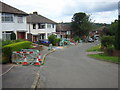
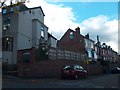
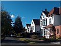
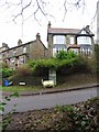
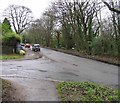
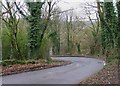
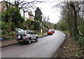
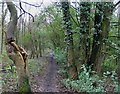
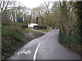
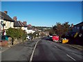
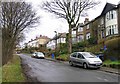
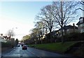
Photos of S10 3PS
Area Information
S10 3PS is a small residential cluster in England, covering just 2,281 square metres. Despite its tiny footprint, the postcode supports a population of 1,375 people. This high density of 602,904 people per square kilometre places it among some of the most concentrated population figures for any defined area. Living in S10 3PS means sharing close proximity with a significant number of neighbours within a very compact space. The area functions as a distinct pocket of housing, separate from larger urban sprawls. Residents here experience a tightly knit environment where every plot counts towards the total population. The sheer volume of people relative to the land area creates a specific rhythm to daily life. You are part of a community where space is limited but presence is strong. This demographic concentration shapes the energy of the neighbourhood. Understanding these physical boundaries helps you appreciate the scale of living arrangements in this specific part of Sheffield. The area is defined by its intensity rather than vast open spaces.
- Area Type
- Postcode
- Area Size
- 2281 m²
- Population
- 1375
- Population Density
- 3506 people/km²
The housing market in S10 3PS reflects a mature, owner-occupied community. Sixty-nine per cent of properties are owner-occupied, while only a small minority are privately rented. Houses dominate the stock, indicating a preference for detached or semi-detached family living over apartments or flats. You are looking at an area designed for permanent settlement rather than short-term leases. This high ownership rate often signals that buyers consider these homes a foundational asset for their lives. The focus on houses rather than higher-density apartments affects both price psychology and available inventory. Prospective buyers here find a market geared towards families or couples seeking space. The lack of significant rental data points in the source confirms the private ownership nature of the estate. When viewing properties in S10 3PS, expect traditional housing stock built for longevity and domestic privacy.
House Prices in S10 3PS
Showing 4 properties
| Address | Type | Beds | Baths | Last Sale Price | Last Sale Date | |
|---|---|---|---|---|---|---|
| 11 Stumperlowe Crescent Road, Sheffield, S10 3PS | house | - | - | £249,950 | Sep 2009 | |
| 17 Stumperlowe Crescent Road, Sheffield, S10 3PS | Detached | - | - | £300,000 | Mar 2006 | |
| 9 Stumperlowe Crescent Road, Sheffield, S10 3PS | Detached | - | - | - | - | |
| 15 Stumperlowe Crescent Road, Sheffield, S10 3PS | Semi-detached | - | - | - | - |
Energy Efficiency in S10 3PS
Daily lifestyle for residents of S10 3PS revolves around a handful of accessible commercial centres. Supermarkets including Tesco Fulwood, Co-op Fulwood, and Spar provide convenient shopping within practical reach. These retailers handle everyday essentials without requiring a long journey into the city. The metro offer includes direct proximity to University of Sheffield facilities, Netherthorpe Road, and West Street. These locations suggest strong links to student life and tertiary education institutions. Rail transport connects you easily to Sheffield Railway Station, Dore & Totley Railway Station, and Darnall Railway Station. These stations facilitate daily commutes across South Yorkshire and beyond. Shopping and transit options are clustered to create a dense, walkable convenience corridor. You do not need a car for minor errands or regular train travel. The mix of high-street names and transport hubs defines the practical rhythm of life here.
Amenities
Schools
Educational options for families living in S10 3PS include Tapton School, which operates as both a primary institution and an academy. The academy variant holds an outstanding Ofsted rating, a testament to its educational standards. This dual-functioning setup provides a consistent educational environment for children growing up in the area. Tapton School serves as a key local facility for students from the postcode. The presence of an outstanding-rated academy offers reassurance to parents prioritising academic quality. Having a school with such a high rating directly on your doorstep is a significant advantage for residents. Families often value the proximity of highly regarded institutions when choosing a neighbourhood. The concentration of top-tier education at a single site means local parents share a strong interest in the school's progress.
| Rank | School | Type | Entry gender | Ages |
|---|
Explore more schools in this area
Go to Schools tabDemographics
The community in S10 3PS is dominated by adults, with a median age of 47 years. Most residents fall within the 30 to 64-year age range. This profile suggests a stability typical of families settling down or professionals established in the area. Home ownership stands at 69 per cent, meaning two out of every three residents own their property outright or have a mortgage. Houses remain the primary form of accommodation throughout the postcode. The resident population is predominantly White, reflecting the broader demographic makeup of the region. With such a high proportion of homeowners, the area attracts people seeking long-term stability over temporary rentals. The age structure indicates a mature neighbourhood where local residents have deep roots. These figures paint a picture of a settled, established community rather than a transient student or commuter hub.
Household Size
Accommodation Type
Tenure
Ethnic Group
Religion
Household Composition
Age
Household Deprivation
NS-SEC
Explore more demographic insights in this area
Go to Demographics tabPlanning
Planning Constraints
- Flood RiskPremium
- Ramsar Wetland SitesPremium
- Area of Outstanding Natural BeautyPremium
- Protected Nature ReservePremium
- Protected WoodlandPremium