Area Overview for S10 3FQ
Photos of S10 3FQ
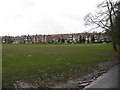
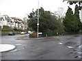
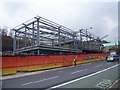
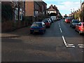
100 photos from this area
Area Information
Key information about the S10 3FQ including its size, population, and administrative classification.
- Area Type
- Postcode
- Area Size
- 1.2 hectares
- Population
- 3539
- Population Density
- 5121 people/km²
House Prices in S10 3FQ
8
Properties
£303,300
Average Sold Price
£79,950
Lowest Price
£400,000
Highest Price
Showing 8 properties
| Address | Type | Beds | Baths | Last Sale Price | Last Sale Date | |
|---|---|---|---|---|---|---|
| 1 The Glade, Sheffield, S10 3FQ | Flat | - | - | £360,000 | Nov 2023 | |
| 7 The Glade, Sheffield, S10 3FQ | Flat | - | - | £350,000 | Mar 2022 | |
| 15 The Glade, Sheffield, S10 3FQ | Flat | - | - | £400,000 | Feb 2021 | |
| 3 The Glade, Sheffield, S10 3FQ | Flat | - | - | £325,000 | Mar 2019 | |
| 17 The Glade, Sheffield, S10 3FQ | Flat | - | - | £367,000 | Jun 2017 | |
| 11 The Glade, Sheffield, S10 3FQ | Flat | - | - | £259,950 | Feb 2016 | |
| 5 The Glade, Sheffield, S10 3FQ | Flat | - | - | £284,500 | Dec 2013 | |
| 9 The Glade, Sheffield, S10 3FQ | Flat | 2 | 1 | £79,950 | Jun 1998 |
Energy Efficiency in S10 3FQ
Amenities
Schools
| Rank | School | Type | Entry gender | Ages |
|---|
Explore more schools in this area
Go to Schools tabDemographics
Household Size
One person
most common
Accommodation Type
Flats
most common
Tenure
70
majority
Ethnic Group
White
most common
Religion
N/A
most common
Household Composition
N/A
most common
Age
22
median
Young Adults (15-29 years)
most common
Household Deprivation
N/A
with no deprivation
NS-SEC
14
in Lower managerial occupations
Explore more demographic insights in this area
Go to Demographics tabPlanning
Planning Constraints
- Flood RiskPremium
- Ramsar Wetland SitesPremium
- Area of Outstanding Natural BeautyPremium
- Protected Nature ReservePremium
- Protected WoodlandPremium