Area Overview for S10 2AA
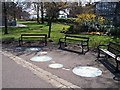
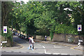
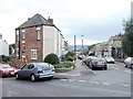
Photos of S10 2AA


Area Information
Living in S10 2AA means residing within a specific postcode area covering a small residential cluster in Sheffield, England. This location forms part of a larger local community where daily life unfolds around nearby transport links and retail hubs. The area holds a population of 1,918 residents, creating a tightly knit environment rather than a sprawling suburban sprawl. You will find this cluster situated in a region that connects easily to key Sheffield destinations. proximity to major thoroughfares and educational institutions defines the practical reality for those calling S10 2AA their home. The immediate surroundings offer a blend of utility and accessibility that suits people seeking a straightforward address in South Yorkshire. You can access supermarkets like Tesco Sheffield and Sainsburys Sheffield within practical walking or driving distance. The character of the neighbourhood is shaped by its proximity to the University of Sheffield and its rail connections. This is not an isolated pocket but a functional part of the city's social and economic fabric. Residents benefit from the convenience of essential services without needing to travel far for most daily tasks.
- Area Type
- Postcode
- Area Size
- Not available
- Population
- 1918
- Population Density
- 10435 people/km²
The property market in S10 2AA is driven by the fact that Houses are the main accommodation type recorded for this postcode. However, the very low home ownership level of 24 per cent indicates that most properties here serve as former family homes now adapted for rented student use or shared ownership. You are likely to encounter a high volume of tenancy agreements rather than mortgageholdings when searching for homes in S10 2AA. This dynamic creates a rental market heavily focused on demand from the 15 to 29 age group. Traditional owneroccupied neighbourhoods with established gardens are being replaced by furnished units catering to young professionals and university students. The small population of 1,918 means the housing stock is concentrated and specific to local needs. Prospective buyers must understand that entering the market here involves navigating a sector where longterm stability is rarer due to the high mobility of residents. The prevalence of houses also suggests that even in a rental market, the underlying assets are substantial dwellings capable of housing multiple students. Prices and values will mirror the strong demand from the University of Sheffield rather than speculative investment trends.
House Prices in S10 2AA
No properties found in this postcode.
Energy Efficiency in S10 2AA
Your lifestyle in S10 2AA is anchored by immediate access to essential retail and leisure facilities. Within practical reach you will find Tesco Sheffield, Sainsburys Sheffield, and Morrisons Broomhill, providing ample variety for grocery shopping and household needs. The area is also minutes from prestigious educational hubs including the University of Sheffield, Netherthorpe Road, and West Street, which inject energy into the local atmosphere. Five railway stations are available nearby including Sheffield Railway Station, Dore & Totley Railway Station, and Darnall Railway Station for wider regional travel. This density of amenities means you do not need a car for most daily tasks. You can walk to supermarkets or catch a tram from nearby stops. The concentration of studentfocused venues and major transport nodes creates a lively environment where restaurants, bars, and study spaces coexist. Living in S10 2AA offers the convenience of a city centre without the density of the core urban zone. The walkability and transport options mean that the area functions as a satellite hub for South Yorkshire.
Amenities
Schools
| Rank | School | Type | Entry gender | Ages |
|---|
Explore more schools in this area
Go to Schools tabDemographics
The community in S10 2AA reflects a very young demographic profile with a median age of just 22 years. Young adults between 15 and 29 years constitute the most common age group, which indicates a population heavily influenced by students and early career professionals. Home ownership in S10 2AA stands at 24 per cent, suggesting the majority of households are tenures in rentals or shared living arrangements. The local accommodation type data confirms that Houses predominate over other dwelling structures in this postcode. The area is predominantly White, reflecting the broader ethnic makeup of the Sheffield region. With families making up only a quarter of households, the area is defined by single people and shared living rather than established family units. This age structure explains the high demand for flats and shared homes near the University of Sheffield. The low home ownership rate contrasts with the physical presence of houses, implying many traditional homes are let out to students. The social fabric is dynamic and transient, with households likely changing occupants more frequently than in older postcodes.
Household Size
Accommodation Type
Tenure
Ethnic Group
Religion
Household Composition
Age
Household Deprivation
NS-SEC
Explore more demographic insights in this area
Go to Demographics tabPlanning
Planning Constraints
- Flood RiskPremium
- Ramsar Wetland SitesPremium
- Area of Outstanding Natural BeautyPremium
- Protected Nature ReservePremium
- Protected WoodlandPremium