Area Overview for S10 1XA
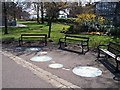
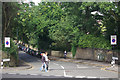
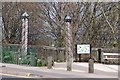
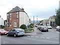
Photos of S10 1XA


Area Information
S10 1XA is a specific postcode area covering a small residential cluster in Sheffield. The location contains a population of 1,509 people, creating a tightly knit environment where neighbours are likely to know one another. You will find this area to be a focused residential zone rather than a sprawling district. Its size allows for a sense of community without the overwhelming scale of larger urban developments. Residents here benefit from a compact layout that supports easy access to local services and amenities. The character of S10 1XA is defined by its residential nature, offering a distinct alternative to the city centre while remaining closely connected to it. Living in S10 1XA means choosing a place with a clear identity as a homey residential pocket. This designation makes it suitable for those who prefer a manageable living environment with defined boundaries and a strong local focus. The area stands out for its concentration of houses within a limited geographical footprint.
- Area Type
- Postcode
- Area Size
- Not available
- Population
- 1509
- Population Density
- 11976 people/km²
The housing market in S10 1XA is characterised as a residential area where houses form the primary accommodation type. With a home ownership rate of 52%, you will find that the majority of properties are owned by the people living in them. This suggests the market is not overwhelmingly rental but rather supports a significant number of owner-occupiers who have invested directly in the area. The predominance of houses over other dwelling types means that the streetscape consists largely of traditional residential structures rather than high-rise flats. This profile appeals to buyers looking for single-family units or semi-detached homes typical of suburban Sheffield settings. The area offers a specific housing stock that caters to those prioritising property ownership within a defined postcode boundary. Understanding the accommodation type and ownership levels helps you anticipate the kinds of transactions likely to occur within S10 1XA. The market here reflects a steady demand for enduring homes within a small, clustered zone.
House Prices in S10 1XA
No properties found in this postcode.
Energy Efficiency in S10 1XA
Residents of S10 1XA have convenient access to a wide range of nearby amenities within practical reach. For shopping needs, you are located close to the Co-op Crookes and two branches of Sainsburys Sheffield, offering ample grocery and retail options. Transport links include five metro stations such as the University of Sheffield, Netherthorpe Road, and Langsett, facilitating easy movement around the city via tram. Rail travel is also straightforward, with Sheffield Railway Station, Darnall Railway Station, and Dore & Totley Railway Station nearby for train commuters. This mix of retail and transport hubs ensures you can run weekly errands or commute to other parts of the UK with ease. The variety of notable locations means daily tasks require minimal travel time. Living in S10 1XA provides a lifestyle supported by essential services without the necessity of long journeys. You benefit from a diverse selection of immediate options for shopping, commuting, and leisure.
Amenities
Schools
Westways Primary School stands as the nearest educational institution to S10 1XA. It operates as a primary school and holds an Ofsted rating of good. This specific rating confirms that the school meets good standards in education and overall performance. While the data lists only one school within easy reach, your proximity to Westways Primary School provides direct access to primary education without the need for complex transport arrangements. The presence of a school with a good rating offers reassurance for families considering S10 1XA as a location for raising children. The absence of secondary or more distant school names in the immediate vicinity suggests that primary education is the local standard, with older children potentially attending schools further away. The single listed option highlights the focused nature of local infrastructure in this residential cluster. Parents in the area rely on this specific school for their younger children's education needs.
| Rank | School | Type | Entry gender | Ages |
|---|
Explore more schools in this area
Go to Schools tabDemographics
The community in S10 1XA is dominated by young adults between the ages of 15 and 29 years. This age range constitutes the most common demographic group within the postcode. The median age for residents is just 22 years, confirming that this is an area populated primarily by younger generations. More than half of the households are owner-occupied, with a home ownership level standing at 52%. This figure indicates that a majority of residents have taken steps to secure their own homes rather than renting. The predominant ethnic group in this area is White, shaping the cultural fabric of the neighbourhood. Most households live in houses, which contrasts with the prevalence of flats found in denser urban zones. These specific figures paint a picture of a stable, relatively young community where homeownership is the norm for the majority. The demographic profile suggests a neighbourhood built around the needs of younger families and individuals seeking stability in the city.
Household Size
Accommodation Type
Tenure
Ethnic Group
Religion
Household Composition
Age
Household Deprivation
NS-SEC
Explore more demographic insights in this area
Go to Demographics tabPlanning
Planning Constraints
- Flood RiskPremium
- Ramsar Wetland SitesPremium
- Area of Outstanding Natural BeautyPremium
- Protected Nature ReservePremium
- Protected WoodlandPremium