Area Overview for S10 1UH
Photos of S10 1UH
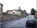
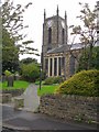
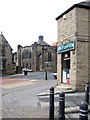
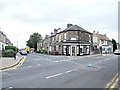
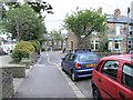
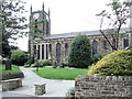
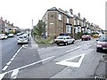
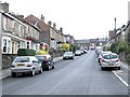
95 photos from this area
Area Information
Key information about the S10 1UH including its size, population, and administrative classification.
- Area Type
- Postcode
- Area Size
- 4889 m²
- Population
- 1509
- Population Density
- 11976 people/km²
House Prices in S10 1UH
31
Properties
£107,915
Average Sold Price
£23,760
Lowest Price
£250,000
Highest Price
Showing 31 properties
| Address | Type | Beds | Baths | Last Sale Price | Last Sale Date | |
|---|---|---|---|---|---|---|
| 116 Crookes, Sheffield, S10 1UH | Terraced | 3 | 2 | £250,000 | Jan 2025 | |
| 140 Crookes, Sheffield, S10 1UH | house | - | - | £240,000 | Sep 2021 | |
| The Pad, 134A Crookes, Sheffield, S10 1UH | Terraced | 5 | - | £220,000 | Nov 2020 | |
| 118 Crookes, Sheffield, S10 1UH | Terraced | 4 | 1 | £170,000 | Nov 2020 | |
| 122 Crookes, Sheffield, S10 1UH | house | - | - | £135,000 | Aug 2018 | |
| 106 Crookes, Sheffield, S10 1UH | Terraced | 2 | - | £120,000 | Sep 2013 | |
| 170A Crookes, Sheffield, S10 1UH | Flat | 2 | - | £31,000 | Oct 2003 | |
| 168A Crookes, Sheffield, S10 1UH | Flat | - | - | £29,500 | Mar 2003 | |
| 112 Crookes, Sheffield, S10 1UH | Terraced | 3 | 1 | £63,500 | Dec 2001 | |
| 110 Crookes, Sheffield, S10 1UH | house | - | - | £58,050 | Dec 2001 |
Page 1 of 4
Energy Efficiency in S10 1UH
Amenities
Schools
| Rank | School | Type | Entry gender | Ages |
|---|
Explore more schools in this area
Go to Schools tabDemographics
Household Size
Family (3-5 people)
most common
Accommodation Type
Houses
most common
Tenure
52
majority
Ethnic Group
White
most common
Religion
N/A
most common
Household Composition
N/A
most common
Age
22
median
Young Adults (15-29 years)
most common
Household Deprivation
N/A
with no deprivation
NS-SEC
36
in Lower managerial occupations
Explore more demographic insights in this area
Go to Demographics tabPlanning
Planning Constraints
- Flood RiskPremium
- Ramsar Wetland SitesPremium
- Area of Outstanding Natural BeautyPremium
- Protected Nature ReservePremium
- Protected WoodlandPremium