Area Overview for S10 1QW
Photos of S10 1QW
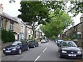
75 photos from this area
Area Information
Key information about the S10 1QW including its size, population, and administrative classification.
- Area Type
- Postcode
- Area Size
- 5334 m²
- Population
- 1504
- Population Density
- 8250 people/km²
House Prices in S10 1QW
41
Properties
£162,886
Average Sold Price
£35,000
Lowest Price
£245,100
Highest Price
Showing 41 properties
| Address | Type | Beds | Baths | Last Sale Price | Last Sale Date | |
|---|---|---|---|---|---|---|
| 31 Longfield Road, Sheffield, S10 1QW | Terraced | 2 | 1 | £214,500 | Jul 2025 | |
| 59 Longfield Road, Sheffield, S10 1QW | Terraced | 2 | 1 | £230,000 | Mar 2025 | |
| 21 Longfield Road, Sheffield, S10 1QW | Terraced | 2 | 1 | £235,000 | Feb 2025 | |
| 11 Longfield Road, Sheffield, S10 1QW | Terraced | 2 | 1 | £156,000 | Jan 2025 | |
| 53 Longfield Road, Sheffield, S10 1QW | Terraced | 2 | 1 | £195,000 | Sep 2024 | |
| 71 Longfield Road, Sheffield, S10 1QW | Terraced | 2 | 1 | £210,000 | Aug 2024 | |
| 65 Longfield Road, Sheffield, S10 1QW | Terraced | 2 | 1 | £245,100 | Nov 2023 | |
| 51 Longfield Road, Sheffield, S10 1QW | Terraced | 2 | 1 | £235,000 | Jul 2023 | |
| 9 Longfield Road, Sheffield, S10 1QW | Terraced | 2 | 1 | £190,500 | May 2023 | |
| 57 Longfield Road, Sheffield, S10 1QW | Terraced | 2 | 1 | £230,000 | Dec 2022 |
Page 1 of 5
Energy Efficiency in S10 1QW
Amenities
Schools
| Rank | School | Type | Entry gender | Ages |
|---|
Explore more schools in this area
Go to Schools tabDemographics
Household Size
Two person
most common
Accommodation Type
Houses
most common
Tenure
66
majority
Ethnic Group
White
most common
Religion
N/A
most common
Household Composition
N/A
most common
Age
47
median
Adults (30-64 years)
most common
Household Deprivation
N/A
with no deprivation
NS-SEC
48
in Lower managerial occupations
Explore more demographic insights in this area
Go to Demographics tabPlanning
Planning Constraints
- Flood RiskPremium
- Ramsar Wetland SitesPremium
- Area of Outstanding Natural BeautyPremium
- Protected Nature ReservePremium
- Protected WoodlandPremium