Area Overview for S10 1PA
Photos of S10 1PA
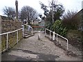
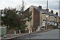
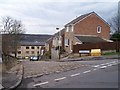
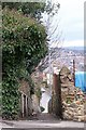
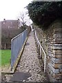
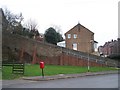
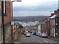
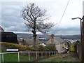
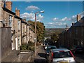
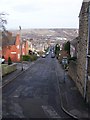
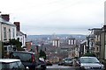
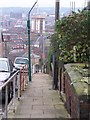
100 photos from this area
Area Information
Key information about the S10 1PA including its size, population, and administrative classification.
- Area Type
- Postcode
- Area Size
- 1.3 hectares
- Population
- 1295
- Population Density
- 10101 people/km²
House Prices in S10 1PA
59
Properties
£180,873
Average Sold Price
£32,000
Lowest Price
£330,000
Highest Price
Showing 59 properties
| Address | Type | Beds | Baths | Last Sale Price | Last Sale Date | |
|---|---|---|---|---|---|---|
| 113 Bradley Street, Sheffield, S10 1PA | house | 3 | - | £280,000 | Jul 2025 | |
| 47 Bradley Street, Sheffield, S10 1PA | Terraced | 3 | 1 | £330,000 | Jan 2025 | |
| 137 Bradley Street, Sheffield, S10 1PA | Terraced | 3 | 1 | £280,000 | Jan 2025 | |
| 83 Bradley Street, Sheffield, S10 1PA | Terraced | 3 | 2 | £290,000 | Nov 2024 | |
| 111 Bradley Street, Sheffield, S10 1PA | Terraced | 3 | 1 | £250,228 | Mar 2024 | |
| 151 Bradley Street, Sheffield, S10 1PA | Terraced | 3 | 1 | £197,500 | May 2023 | |
| 127 Bradley Street, Sheffield, S10 1PA | Retail | 3 | - | £255,000 | Nov 2022 | |
| 117 Bradley Street, Sheffield, S10 1PA | Retail | 2 | 1 | £176,500 | Jul 2022 | |
| 103 Bradley Street, Sheffield, S10 1PA | Terraced | 3 | - | £251,000 | Jun 2021 | |
| 17 Bradley Street, Sheffield, S10 1PA | Terraced | 3 | - | £250,000 | Jan 2021 |
Page 1 of 6
Energy Efficiency in S10 1PA
Amenities
Schools
| Rank | School | Type | Entry gender | Ages |
|---|
Explore more schools in this area
Go to Schools tabDemographics
Household Size
Two person
most common
Accommodation Type
Houses
most common
Tenure
62
majority
Ethnic Group
White
most common
Religion
N/A
most common
Household Composition
N/A
most common
Age
47
median
Adults (30-64 years)
most common
Household Deprivation
N/A
with no deprivation
NS-SEC
49
in Lower managerial occupations
Explore more demographic insights in this area
Go to Demographics tabPlanning
Planning Constraints
- Flood RiskPremium
- Ramsar Wetland SitesPremium
- Area of Outstanding Natural BeautyPremium
- Protected Nature ReservePremium
- Protected WoodlandPremium