Area Overview for S1 2BY
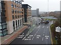
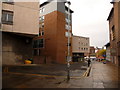
Photos of S1 2BY


Area Information
Living in S1 2BY places you at the heart of Sheffield's central residential cluster, where a specific postcode definition overlays a population of 2674 residents. This area functions as a compact neighbourhood rather than a sprawling suburb, offering immediate access to the city's commercial and transport hubs. Daily life here is defined by density and proximity; you are in close physical reach of major transport nodes and retail centres without the isolation often found in outer districts. The environment is distinctly urban, shaped by the needs of the 2674 people who call this small postcode zone home. You will find yourself surrounded by the infrastructure of a major city centre, including frequent public transport options and essential services within walking distance. The location suits those who prioritise convenience over quiet seclusion, as you trade extensive green spaces for immediate connectivity to employment and amenities. Understanding the layout of S1 2BY means knowing that every journey takes few minutes to reach critical destinations like train stations and supermarkets. The character of living in S1 2BY is pragmatic, designed for efficiency and speed rather than expansive leisure grounds. ### The community profile of S1 2BY reflects a youthful demographic, with a median age of 22 years. The most common age range is 15 to 29 years, indicating a neighbourhood dominated by students, young professionals, and recent graduates. Only 25% of residents own their homes, meaning the vast majority are likely tenants or first-time buyers on low deposits. This low ownership rate aligns with the predominant accommodation type, which consists of flats. These flats cater to individual living arrangements or shared households typical of the younger population. While the predominant ethnic group is White, the high proportion of young adults suggests a dynamic and transient social environment. You should expect a social scene driven by university life and career starting points rather than established family matriarchies. The demographic data paints a clear picture of a district in flux, where long-term residency is less common than temporary accommodation tied to work or study cycles. Living in S1 2BY means engaging with a community where the average household tenure is likely short. ### The property market in S1 2BY is overwhelmingly characterised by rental housing rather than owner-occupied stock. With home ownership standing at just 25%, the housing landscape is defined by the vast majority of residents paying rent. The predominant accommodation type is flats, a design choice that maximises space efficiency within an urban setting of limited land. This housing stock supports a lifestyle suited to single individuals, couples, or shared households rather than large families seeking detached properties. When viewing homes in S1 2BY, you will encounter modern layouts or refurbished units optimised for smaller demographics. The low ownership percentage signals that this area is not a traditional family estate passed down through generations but a city centre hub for transient living. Buyers considering this postcode must approach their search with an awareness that they are entering a high-demand rental market where competition for purchase is fierce due to limited stock. The market behaviour here mirrors that of other central Sheffield zones, focusing on convenience and accessibility over garden space or semi-detached structures. ### Families living near S1 2BY have access to a specific selection of educational institutions, catering primarily to early years and primary education. Grace Owen Nursery School is located nearby, serving the youngest children in the postcode area. For primary education, Park Hill Primary School and Park Hill Middle School provideoptions for school-age children. Although Sheffield Hallam University is listed in the vicinity, it functions as a higher education institution rather than a school, though it heavily influences the student population in S1 2BY. The mix of schools indicates a focus on foundational education rather than secondary schooling within immediate reach. You will find that the local offerings are concentrated in the early years and primary sectors, with older students likely commuting further for secondary education. Living in S1 2BY means your children's education journey starts with these specific local facilities before potentially diverging to larger secondary colleges elsewhere in the city. ### Digital connectivity in S1 2BY is robust, supporting remote work and seamless daily communication. Your fixed broadband score reaches 98 out of 100, indicating excellent speeds and reliability for high-bandwidth activities. Similarly, your mobile coverage score stands at 85 out of 100, which represents good to excellent range across the neighbourhood. This high-quality digital infrastructure ensures that working from home or streaming multiple devices simultaneously rarely causes interruptions. You can rely on a stable connection for video calls, cloud storage, and online learning. The physical transport network complements this digital connectivity with frequent rail options. Sheffield Railway Station, Darnall Railway Station, and Medowhall Railway Station are all within practical reach, allowing quick commutes to the rest of the UK. Additionally, the Sheffield Supertram provides further mobility, with stops at Castle Square, Fitzalan Square, and lines extending to Ponds Forge and Medowhall. Living in S1 2BY means you have both digital and physical networks that integrate perfectly for a busy urban lifestyle. ### Your daily lifestyle in S1 2BY revolves around the extensive amenities located within immediate practical reach. For shopping needs, five retail options are nearby, including Tesco Eyre, Sainsburys Sheffield, and M&S Fargate. These specific venues ensure you have access to groceries and general merchandise without requiring a long drive. Transport convenience is further enhanced by five rail stations close by, including Sheffield Railway Station, Darnall Railway Station, and Medowhall Railway Station. The Sheffield Supertram network also supports your mobility, with key stops at Castle Square, Fitzalan Square, and destinations extending to Ponds Forge and Medowhall. You can walk to supermarket chains or catch a train within minutes of leaving your flat. This concentration of services creates a highly convenient environment where essential errands take minimal effort. Living in S1 2BY means your leisure and daily utility are dictated by the density of these nearby facilities. ### Safety assessments for S1 2BY reveal a mixed picture that you must weigh carefully against other lifestyle factors. Three environmental safety assessments pass without issue: Flood Risk, Ramsar Wetland Sites, Area of Outstanding Natural Beauty, Protected Nature Reserve, and Protected Woodland all show zero risk scores. This means you face no planning constraints regarding flooding or protected natural areas. However, the Crime Risk assessment shows a critical level with a score of 1 out of 100. This score indicates high crime risk where crime rates are significantly above average. The description for this assessment explicitly states that enhanced security measures are recommended. While the environment is free from planning restrictions like flood zones, the safety score demands vigilance. Living in S1 2BY requires you to be aware of the elevated crime statistics and consider securing your property accordingly. The contrasting scores highlight a neighbourhood that is environmentally safe but potentially contentious regarding personal security. ### Who are the typical residents of S1 2BY and what is the community feel like?The median age in S1 2BY is 22 years, making it a youthful area dominated by people aged 15 to 29. With only 25% home ownership and a high concentration of flats, the community feels transient and campus-like rather than a traditional family estate. You will encounter a population of students and young professionals prioritising urban convenience. What schools and educational facilities are available near S1 2BY?Families have access to Grace Owen Nursery School, Park Hill Primary School, and Park Hill Middle School. While Sheffield Hallam University is nearby, it serves as a higher education institution. The immediate area focuses on early years and primary education, catering to the younger demographic living in flats. How good is the transport and digital connectivity in this postcode?Digital infrastructure is excellent, with a broadband quality score of 98 and a mobile coverage score of 85. Physically, you are near five railway stations including Sheffield Railway Station, plus five Metro tram stops like Castle Square. This combination offers superior options for both remote work and daily commutes across the region. Is S1 2BY a safe place to live considering recent crime statistics?The area passes all environmental safety checks with zero flood or planning constraint risks. However, the crime risk assessment is critical, scoring 1 out of 100 because crime rates are above average. Residents are advised to implement enhanced security measures due to this high risk profile. What shops and amenities can I access daily while living in S1 2BY?You have five retail outlets within reach, specifically including Tesco Eyre and Sainsburys Sheffield. Transport is equally accessible with five rail stations and five Metro stops like Fitzalan Square nearby. This density ensures your daily errands and travel needs are met without long journeys.
- Area Type
- Postcode
- Area Size
- Not available
- Population
- 2674
- Population Density
- 2934 people/km²
The property market in S1 2BY is overwhelmingly characterised by rental housing rather than owner-occupied stock. With home ownership standing at just 25%, the housing landscape is defined by the vast majority of residents paying rent. The predominant accommodation type is flats, a design choice that maximises space efficiency within an urban setting of limited land. This housing stock supports a lifestyle suited to single individuals, couples, or shared households rather than large families seeking detached properties. When viewing homes in S1 2BY, you will encounter modern layouts or refurbished units optimised for smaller demographics. The low ownership percentage signals that this area is not a traditional family estate passed down through generations but a city centre hub for transient living. Buyers considering this postcode must approach their search with an awareness that they are entering a high-demand rental market where competition for purchase is fierce due to limited stock. The market behaviour here mirrors that of other central Sheffield zones, focusing on convenience and accessibility over garden space or semi-detached structures. ### Families living near S1 2BY have access to a specific selection of educational institutions, catering primarily to early years and primary education. Grace Owen Nursery School is located nearby, serving the youngest children in the postcode area. For primary education, Park Hill Primary School and Park Hill Middle School provideoptions for school-age children. Although Sheffield Hallam University is listed in the vicinity, it functions as a higher education institution rather than a school, though it heavily influences the student population in S1 2BY. The mix of schools indicates a focus on foundational education rather than secondary schooling within immediate reach. You will find that the local offerings are concentrated in the early years and primary sectors, with older students likely commuting further for secondary education. Living in S1 2BY means your children's education journey starts with these specific local facilities before potentially diverging to larger secondary colleges elsewhere in the city. ### Digital connectivity in S1 2BY is robust, supporting remote work and seamless daily communication. Your fixed broadband score reaches 98 out of 100, indicating excellent speeds and reliability for high-bandwidth activities. Similarly, your mobile coverage score stands at 85 out of 100, which represents good to excellent range across the neighbourhood. This high-quality digital infrastructure ensures that working from home or streaming multiple devices simultaneously rarely causes interruptions. You can rely on a stable connection for video calls, cloud storage, and online learning. The physical transport network complements this digital connectivity with frequent rail options. Sheffield Railway Station, Darnall Railway Station, and Medowhall Railway Station are all within practical reach, allowing quick commutes to the rest of the UK. Additionally, the Sheffield Supertram provides further mobility, with stops at Castle Square, Fitzalan Square, and lines extending to Ponds Forge and Medowhall. Living in S1 2BY means you have both digital and physical networks that integrate perfectly for a busy urban lifestyle. ### Your daily lifestyle in S1 2BY revolves around the extensive amenities located within immediate practical reach. For shopping needs, five retail options are nearby, including Tesco Eyre, Sainsburys Sheffield, and M&S Fargate. These specific venues ensure you have access to groceries and general merchandise without requiring a long drive. Transport convenience is further enhanced by five rail stations close by, including Sheffield Railway Station, Darnall Railway Station, and Medowhall Railway Station. The Sheffield Supertram network also supports your mobility, with key stops at Castle Square, Fitzalan Square, and destinations extending to Ponds Forge and Medowhall. You can walk to supermarket chains or catch a train within minutes of leaving your flat. This concentration of services creates a highly convenient environment where essential errands take minimal effort. Living in S1 2BY means your leisure and daily utility are dictated by the density of these nearby facilities. ### Safety assessments for S1 2BY reveal a mixed picture that you must weigh carefully against other lifestyle factors. Three environmental safety assessments pass without issue: Flood Risk, Ramsar Wetland Sites, Area of Outstanding Natural Beauty, Protected Nature Reserve, and Protected Woodland all show zero risk scores. This means you face no planning constraints regarding flooding or protected natural areas. However, the Crime Risk assessment shows a critical level with a score of 1 out of 100. This score indicates high crime risk where crime rates are significantly above average. The description for this assessment explicitly states that enhanced security measures are recommended. While the environment is free from planning restrictions like flood zones, the safety score demands vigilance. Living in S1 2BY requires you to be aware of the elevated crime statistics and consider securing your property accordingly. The contrasting scores highlight a neighbourhood that is environmentally safe but potentially contentious regarding personal security. ### Who are the typical residents of S1 2BY and what is the community feel like?The median age in S1 2BY is 22 years, making it a youthful area dominated by people aged 15 to 29. With only 25% home ownership and a high concentration of flats, the community feels transient and campus-like rather than a traditional family estate. You will encounter a population of students and young professionals prioritising urban convenience. What schools and educational facilities are available near S1 2BY?Families have access to Grace Owen Nursery School, Park Hill Primary School, and Park Hill Middle School. While Sheffield Hallam University is nearby, it serves as a higher education institution. The immediate area focuses on early years and primary education, catering to the younger demographic living in flats. How good is the transport and digital connectivity in this postcode?Digital infrastructure is excellent, with a broadband quality score of 98 and a mobile coverage score of 85. Physically, you are near five railway stations including Sheffield Railway Station, plus five Metro tram stops like Castle Square. This combination offers superior options for both remote work and daily commutes across the region. Is S1 2BY a safe place to live considering recent crime statistics?The area passes all environmental safety checks with zero flood or planning constraint risks. However, the crime risk assessment is critical, scoring 1 out of 100 because crime rates are above average. Residents are advised to implement enhanced security measures due to this high risk profile. What shops and amenities can I access daily while living in S1 2BY?You have five retail outlets within reach, specifically including Tesco Eyre and Sainsburys Sheffield. Transport is equally accessible with five rail stations and five Metro stops like Fitzalan Square nearby. This density ensures your daily errands and travel needs are met without long journeys.
House Prices in S1 2BY
No properties found in this postcode.
Energy Efficiency in S1 2BY
Your daily lifestyle in S1 2BY revolves around the extensive amenities located within immediate practical reach. For shopping needs, five retail options are nearby, including Tesco Eyre, Sainsburys Sheffield, and M&S Fargate. These specific venues ensure you have access to groceries and general merchandise without requiring a long drive. Transport convenience is further enhanced by five rail stations close by, including Sheffield Railway Station, Darnall Railway Station, and Medowhall Railway Station. The Sheffield Supertram network also supports your mobility, with key stops at Castle Square, Fitzalan Square, and destinations extending to Ponds Forge and Medowhall. You can walk to supermarket chains or catch a train within minutes of leaving your flat. This concentration of services creates a highly convenient environment where essential errands take minimal effort. Living in S1 2BY means your leisure and daily utility are dictated by the density of these nearby facilities. ### Safety assessments for S1 2BY reveal a mixed picture that you must weigh carefully against other lifestyle factors. Three environmental safety assessments pass without issue: Flood Risk, Ramsar Wetland Sites, Area of Outstanding Natural Beauty, Protected Nature Reserve, and Protected Woodland all show zero risk scores. This means you face no planning constraints regarding flooding or protected natural areas. However, the Crime Risk assessment shows a critical level with a score of 1 out of 100. This score indicates high crime risk where crime rates are significantly above average. The description for this assessment explicitly states that enhanced security measures are recommended. While the environment is free from planning restrictions like flood zones, the safety score demands vigilance. Living in S1 2BY requires you to be aware of the elevated crime statistics and consider securing your property accordingly. The contrasting scores highlight a neighbourhood that is environmentally safe but potentially contentious regarding personal security. ### Who are the typical residents of S1 2BY and what is the community feel like?The median age in S1 2BY is 22 years, making it a youthful area dominated by people aged 15 to 29. With only 25% home ownership and a high concentration of flats, the community feels transient and campus-like rather than a traditional family estate. You will encounter a population of students and young professionals prioritising urban convenience. What schools and educational facilities are available near S1 2BY?Families have access to Grace Owen Nursery School, Park Hill Primary School, and Park Hill Middle School. While Sheffield Hallam University is nearby, it serves as a higher education institution. The immediate area focuses on early years and primary education, catering to the younger demographic living in flats. How good is the transport and digital connectivity in this postcode?Digital infrastructure is excellent, with a broadband quality score of 98 and a mobile coverage score of 85. Physically, you are near five railway stations including Sheffield Railway Station, plus five Metro tram stops like Castle Square. This combination offers superior options for both remote work and daily commutes across the region. Is S1 2BY a safe place to live considering recent crime statistics?The area passes all environmental safety checks with zero flood or planning constraint risks. However, the crime risk assessment is critical, scoring 1 out of 100 because crime rates are above average. Residents are advised to implement enhanced security measures due to this high risk profile. What shops and amenities can I access daily while living in S1 2BY?You have five retail outlets within reach, specifically including Tesco Eyre and Sainsburys Sheffield. Transport is equally accessible with five rail stations and five Metro stops like Fitzalan Square nearby. This density ensures your daily errands and travel needs are met without long journeys.
Amenities
Schools
Families living near S1 2BY have access to a specific selection of educational institutions, catering primarily to early years and primary education. Grace Owen Nursery School is located nearby, serving the youngest children in the postcode area. For primary education, Park Hill Primary School and Park Hill Middle School provideoptions for school-age children. Although Sheffield Hallam University is listed in the vicinity, it functions as a higher education institution rather than a school, though it heavily influences the student population in S1 2BY. The mix of schools indicates a focus on foundational education rather than secondary schooling within immediate reach. You will find that the local offerings are concentrated in the early years and primary sectors, with older students likely commuting further for secondary education. Living in S1 2BY means your children's education journey starts with these specific local facilities before potentially diverging to larger secondary colleges elsewhere in the city. ### Digital connectivity in S1 2BY is robust, supporting remote work and seamless daily communication. Your fixed broadband score reaches 98 out of 100, indicating excellent speeds and reliability for high-bandwidth activities. Similarly, your mobile coverage score stands at 85 out of 100, which represents good to excellent range across the neighbourhood. This high-quality digital infrastructure ensures that working from home or streaming multiple devices simultaneously rarely causes interruptions. You can rely on a stable connection for video calls, cloud storage, and online learning. The physical transport network complements this digital connectivity with frequent rail options. Sheffield Railway Station, Darnall Railway Station, and Medowhall Railway Station are all within practical reach, allowing quick commutes to the rest of the UK. Additionally, the Sheffield Supertram provides further mobility, with stops at Castle Square, Fitzalan Square, and lines extending to Ponds Forge and Medowhall. Living in S1 2BY means you have both digital and physical networks that integrate perfectly for a busy urban lifestyle. ### Your daily lifestyle in S1 2BY revolves around the extensive amenities located within immediate practical reach. For shopping needs, five retail options are nearby, including Tesco Eyre, Sainsburys Sheffield, and M&S Fargate. These specific venues ensure you have access to groceries and general merchandise without requiring a long drive. Transport convenience is further enhanced by five rail stations close by, including Sheffield Railway Station, Darnall Railway Station, and Medowhall Railway Station. The Sheffield Supertram network also supports your mobility, with key stops at Castle Square, Fitzalan Square, and destinations extending to Ponds Forge and Medowhall. You can walk to supermarket chains or catch a train within minutes of leaving your flat. This concentration of services creates a highly convenient environment where essential errands take minimal effort. Living in S1 2BY means your leisure and daily utility are dictated by the density of these nearby facilities. ### Safety assessments for S1 2BY reveal a mixed picture that you must weigh carefully against other lifestyle factors. Three environmental safety assessments pass without issue: Flood Risk, Ramsar Wetland Sites, Area of Outstanding Natural Beauty, Protected Nature Reserve, and Protected Woodland all show zero risk scores. This means you face no planning constraints regarding flooding or protected natural areas. However, the Crime Risk assessment shows a critical level with a score of 1 out of 100. This score indicates high crime risk where crime rates are significantly above average. The description for this assessment explicitly states that enhanced security measures are recommended. While the environment is free from planning restrictions like flood zones, the safety score demands vigilance. Living in S1 2BY requires you to be aware of the elevated crime statistics and consider securing your property accordingly. The contrasting scores highlight a neighbourhood that is environmentally safe but potentially contentious regarding personal security. ### Who are the typical residents of S1 2BY and what is the community feel like?The median age in S1 2BY is 22 years, making it a youthful area dominated by people aged 15 to 29. With only 25% home ownership and a high concentration of flats, the community feels transient and campus-like rather than a traditional family estate. You will encounter a population of students and young professionals prioritising urban convenience. What schools and educational facilities are available near S1 2BY?Families have access to Grace Owen Nursery School, Park Hill Primary School, and Park Hill Middle School. While Sheffield Hallam University is nearby, it serves as a higher education institution. The immediate area focuses on early years and primary education, catering to the younger demographic living in flats. How good is the transport and digital connectivity in this postcode?Digital infrastructure is excellent, with a broadband quality score of 98 and a mobile coverage score of 85. Physically, you are near five railway stations including Sheffield Railway Station, plus five Metro tram stops like Castle Square. This combination offers superior options for both remote work and daily commutes across the region. Is S1 2BY a safe place to live considering recent crime statistics?The area passes all environmental safety checks with zero flood or planning constraint risks. However, the crime risk assessment is critical, scoring 1 out of 100 because crime rates are above average. Residents are advised to implement enhanced security measures due to this high risk profile. What shops and amenities can I access daily while living in S1 2BY?You have five retail outlets within reach, specifically including Tesco Eyre and Sainsburys Sheffield. Transport is equally accessible with five rail stations and five Metro stops like Fitzalan Square nearby. This density ensures your daily errands and travel needs are met without long journeys.
| Rank | School | Type | Entry gender | Ages |
|---|
Explore more schools in this area
Go to Schools tabDemographics
The community profile of S1 2BY reflects a youthful demographic, with a median age of 22 years. The most common age range is 15 to 29 years, indicating a neighbourhood dominated by students, young professionals, and recent graduates. Only 25% of residents own their homes, meaning the vast majority are likely tenants or first-time buyers on low deposits. This low ownership rate aligns with the predominant accommodation type, which consists of flats. These flats cater to individual living arrangements or shared households typical of the younger population. While the predominant ethnic group is White, the high proportion of young adults suggests a dynamic and transient social environment. You should expect a social scene driven by university life and career starting points rather than established family matriarchies. The demographic data paints a clear picture of a district in flux, where long-term residency is less common than temporary accommodation tied to work or study cycles. Living in S1 2BY means engaging with a community where the average household tenure is likely short. ### The property market in S1 2BY is overwhelmingly characterised by rental housing rather than owner-occupied stock. With home ownership standing at just 25%, the housing landscape is defined by the vast majority of residents paying rent. The predominant accommodation type is flats, a design choice that maximises space efficiency within an urban setting of limited land. This housing stock supports a lifestyle suited to single individuals, couples, or shared households rather than large families seeking detached properties. When viewing homes in S1 2BY, you will encounter modern layouts or refurbished units optimised for smaller demographics. The low ownership percentage signals that this area is not a traditional family estate passed down through generations but a city centre hub for transient living. Buyers considering this postcode must approach their search with an awareness that they are entering a high-demand rental market where competition for purchase is fierce due to limited stock. The market behaviour here mirrors that of other central Sheffield zones, focusing on convenience and accessibility over garden space or semi-detached structures. ### Families living near S1 2BY have access to a specific selection of educational institutions, catering primarily to early years and primary education. Grace Owen Nursery School is located nearby, serving the youngest children in the postcode area. For primary education, Park Hill Primary School and Park Hill Middle School provideoptions for school-age children. Although Sheffield Hallam University is listed in the vicinity, it functions as a higher education institution rather than a school, though it heavily influences the student population in S1 2BY. The mix of schools indicates a focus on foundational education rather than secondary schooling within immediate reach. You will find that the local offerings are concentrated in the early years and primary sectors, with older students likely commuting further for secondary education. Living in S1 2BY means your children's education journey starts with these specific local facilities before potentially diverging to larger secondary colleges elsewhere in the city. ### Digital connectivity in S1 2BY is robust, supporting remote work and seamless daily communication. Your fixed broadband score reaches 98 out of 100, indicating excellent speeds and reliability for high-bandwidth activities. Similarly, your mobile coverage score stands at 85 out of 100, which represents good to excellent range across the neighbourhood. This high-quality digital infrastructure ensures that working from home or streaming multiple devices simultaneously rarely causes interruptions. You can rely on a stable connection for video calls, cloud storage, and online learning. The physical transport network complements this digital connectivity with frequent rail options. Sheffield Railway Station, Darnall Railway Station, and Medowhall Railway Station are all within practical reach, allowing quick commutes to the rest of the UK. Additionally, the Sheffield Supertram provides further mobility, with stops at Castle Square, Fitzalan Square, and lines extending to Ponds Forge and Medowhall. Living in S1 2BY means you have both digital and physical networks that integrate perfectly for a busy urban lifestyle. ### Your daily lifestyle in S1 2BY revolves around the extensive amenities located within immediate practical reach. For shopping needs, five retail options are nearby, including Tesco Eyre, Sainsburys Sheffield, and M&S Fargate. These specific venues ensure you have access to groceries and general merchandise without requiring a long drive. Transport convenience is further enhanced by five rail stations close by, including Sheffield Railway Station, Darnall Railway Station, and Medowhall Railway Station. The Sheffield Supertram network also supports your mobility, with key stops at Castle Square, Fitzalan Square, and destinations extending to Ponds Forge and Medowhall. You can walk to supermarket chains or catch a train within minutes of leaving your flat. This concentration of services creates a highly convenient environment where essential errands take minimal effort. Living in S1 2BY means your leisure and daily utility are dictated by the density of these nearby facilities. ### Safety assessments for S1 2BY reveal a mixed picture that you must weigh carefully against other lifestyle factors. Three environmental safety assessments pass without issue: Flood Risk, Ramsar Wetland Sites, Area of Outstanding Natural Beauty, Protected Nature Reserve, and Protected Woodland all show zero risk scores. This means you face no planning constraints regarding flooding or protected natural areas. However, the Crime Risk assessment shows a critical level with a score of 1 out of 100. This score indicates high crime risk where crime rates are significantly above average. The description for this assessment explicitly states that enhanced security measures are recommended. While the environment is free from planning restrictions like flood zones, the safety score demands vigilance. Living in S1 2BY requires you to be aware of the elevated crime statistics and consider securing your property accordingly. The contrasting scores highlight a neighbourhood that is environmentally safe but potentially contentious regarding personal security. ### Who are the typical residents of S1 2BY and what is the community feel like?The median age in S1 2BY is 22 years, making it a youthful area dominated by people aged 15 to 29. With only 25% home ownership and a high concentration of flats, the community feels transient and campus-like rather than a traditional family estate. You will encounter a population of students and young professionals prioritising urban convenience. What schools and educational facilities are available near S1 2BY?Families have access to Grace Owen Nursery School, Park Hill Primary School, and Park Hill Middle School. While Sheffield Hallam University is nearby, it serves as a higher education institution. The immediate area focuses on early years and primary education, catering to the younger demographic living in flats. How good is the transport and digital connectivity in this postcode?Digital infrastructure is excellent, with a broadband quality score of 98 and a mobile coverage score of 85. Physically, you are near five railway stations including Sheffield Railway Station, plus five Metro tram stops like Castle Square. This combination offers superior options for both remote work and daily commutes across the region. Is S1 2BY a safe place to live considering recent crime statistics?The area passes all environmental safety checks with zero flood or planning constraint risks. However, the crime risk assessment is critical, scoring 1 out of 100 because crime rates are above average. Residents are advised to implement enhanced security measures due to this high risk profile. What shops and amenities can I access daily while living in S1 2BY?You have five retail outlets within reach, specifically including Tesco Eyre and Sainsburys Sheffield. Transport is equally accessible with five rail stations and five Metro stops like Fitzalan Square nearby. This density ensures your daily errands and travel needs are met without long journeys.
Household Size
Accommodation Type
Tenure
Ethnic Group
Religion
Household Composition
Age
Household Deprivation
NS-SEC
Explore more demographic insights in this area
Go to Demographics tabPlanning
Planning Constraints
- Flood RiskPremium
- Ramsar Wetland SitesPremium
- Area of Outstanding Natural BeautyPremium
- Protected Nature ReservePremium
- Protected WoodlandPremium