Area Overview for S1 1RB
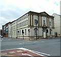
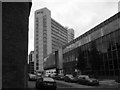
Photos of S1 1RB


Area Information
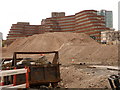
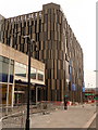
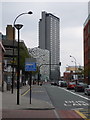
S1 1RB is a small residential cluster within Sheffield, England, defined by its specific postcode boundaries rather than broad neighbourhood distinctions. This area accommodates a population of 1469 people, creating a tightly knit community where daily interactions often carry weight. Life here is shaped by the compact nature of the postcode, which registers as a distinct residential zone for planning and demographic purposes. You will find that living in S1 1RB involves navigating a dense collection of flats designed for efficiency rather than suburban sprawl. The area's identity is rooted in its function as a concentrated living space rather than a sprawling district with varied sub-categories. Despite its small footprint, the location offers direct access to major Sheffield transport links. Proximity to Sheffield Railway Station provides immediate connectivity, while the surrounding postcode area benefits from multiple metro and rail options. This accessibility makes S1 1RB a practical choice for those prioritising urban convenience over isolated tranquillity. The housing stock reflects a shift towards modern living, with flats dominating the accommodation landscape. You are moving into an environment where space is optimised, appealing to young professionals and students who value location over volume. The area represents a specific slice of Sheffield's urban fabric, where high-density living meets metropolitan opportunity.
- Area Type
- Postcode
- Area Size
- Not available
- Population
- 1469
- Population Density
- 8439 people/km²
The property market in S1 1RB is characterised by a dominance of flats, which constitutes the primary accommodation type in this small postcode area. You are looking at a landscape where individual houses are scarce, and multi-unit buildings form the standard living arrangement. Home ownership is recorded at just 13%, confirming that S1 1RB functions overwhelmingly as a rental sector. This market structure indicates that existing owners are a minority, and most transactions involve letting agreements rather than purchases. For buyers, this means navigating an area where investment often targets rental yields rather than long-term family retention. The high concentration of flats suggests that space is efficient and designed for urban living rather than traditional household expansion. If you seek to buy homes in S1 1RB, you should expect higher competition for limited ownership stock compared to the plentiful rental options. The lack of house data in the provided figures implies that the architectural style is predominantly flat-based, catering to singles, couples, or shared living situations. Property values and trends are likely influenced heavily by the area's proximity to employment hubs and the University of Sheffield. Buyers should consider that the 13% ownership rate reflects a community where stability is less common, and turnover may be higher than in suburban neighbours. The market here is fluid, responsive to student cycles and job market shifts in Greater Sheffield.
House Prices in S1 1RB
No properties found in this postcode.
Energy Efficiency in S1 1RB
Living in S1 1RB places you within striking distance of essential retail and leisure facilities in Sheffield. You have immediate access to five retail venues, including Sainsburys Sheffield, Tesco Eyre, and Sainsburys The, ensuring your grocery and shopping needs are easily met without long journeys. The area is well-served by public transport, five metro stops, and five train stations, all clustered within practical reach. Notable rail hubs include Sheffield Railway Station, Darnall Railway Station, and Medowhall Railway Station. These connections allow you to travel quickly to city centre attractions or regional destinations without relying on a personal car. Your daily routine benefits from the concentration of amenities near S1 1RB. Walking or short public transport trips take you to Sainsburys Sheffield or Tesco Eyre for daily necessities. The metro system offers frequent services from stops like City Hall, bridging the gap between your flat and the wider city. If you enjoy essentials rather than leisure complexes, the nearby retail offerings provide sufficient variety for a standard household. The proximity to Sheffield Railway Station means major shopping events at Meadowhall or business districts in the city centre are easily accessible. Life in this postcode is functional and convenient, prioritising access over exclusivity. You do not need to drive to get to shops, making the lifestyle efficient for a population of 1469 residents who value their time.
Amenities
Schools
| Rank | School | Type | Entry gender | Ages |
|---|
Explore more schools in this area
Go to Schools tabDemographics
The community in S1 1RB is defined by its youthful energy, with a median age of just 22 years. You will find that the most common age range for residents falls between 15 and 29 years, indicating a population heavily weighted towards young adults. This demographic profile suggests an area frequently occupied by students, young professionals, or those in early-career stages. Home ownership stands at a low 13%, which strongly points to a rental market rather than a settled, owner-occupied neighbourhood. The vast majority of locals rent their properties, reflecting a transient or temporary lifestyle common among younger demographics. Accommodation types in S1 1RB consist almost entirely of flats. This structural choice aligns perfectly with the young age profile and the low ownership rate, as flats are often lower cost and easier to rent. The predominant ethnic group in the area is White, providing a clear picture of the current community composition. While the area is youthful, there is no data supplied regarding specific education levels or employment sectors, so you cannot make assumptions about those specific professional pathways. The low home ownership figure of 13% means you are unlikely to find many families with generations of roots established here. Instead, the social fabric relies on the diverse influx of young people moving into these flats across the postcode area.
Household Size
Accommodation Type
Tenure
Ethnic Group
Religion
Household Composition
Age
Household Deprivation
NS-SEC
Explore more demographic insights in this area
Go to Demographics tabPlanning
Planning Constraints
- Flood RiskPremium
- Ramsar Wetland SitesPremium
- Area of Outstanding Natural BeautyPremium
- Protected Nature ReservePremium
- Protected WoodlandPremium